/ South Island, Southland / By George
The Catlins were a much talked about destination by travellers we had met along the journey, and even our neighbours back home spoke exceptionally highly of this slice of the country, so we had high expectations of this area. On the way from Invercargill to our first destination in the Catlins, we stopped briefly at ‘Ashers Road’ to take a photo for our grandson Asher. Whilst at this road we quickly checked out ‘The Lignite Pit Cafe and Gardens’, which is a campground that accommodates motorhomes. We didn’t get a good look at the motorhome parking area unfortunately as we were intercepted by the proprietor. He was very pleasant and seemed keen for us to stay, but that wasn’t on our agenda. We had a quick look from the carpark whilst still in the wagon and the gardens and pond close to the camp area looked quite manicured. However our destination for tonight was Fortrose and the day was already well advanced. After travelling further we stopped briefly to view the whitebait huts lined up along the Mataura River. Whilst not in season you could imagine the throngs of resolute whitebaiters who return annually to this venue in search of contents for the mercurial ‘whitebait fritters’ (not too heavy on the egg!). Some come from as far away as the North Island to make ancestral pilgrimages to these huts.
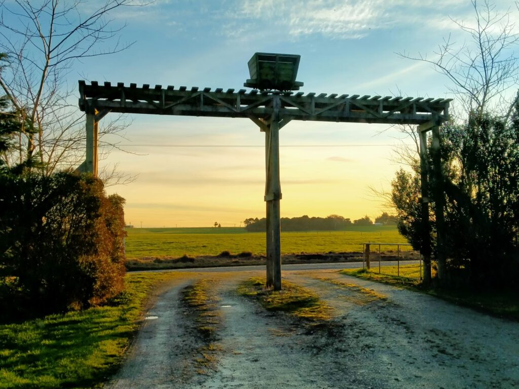
FORTROSE
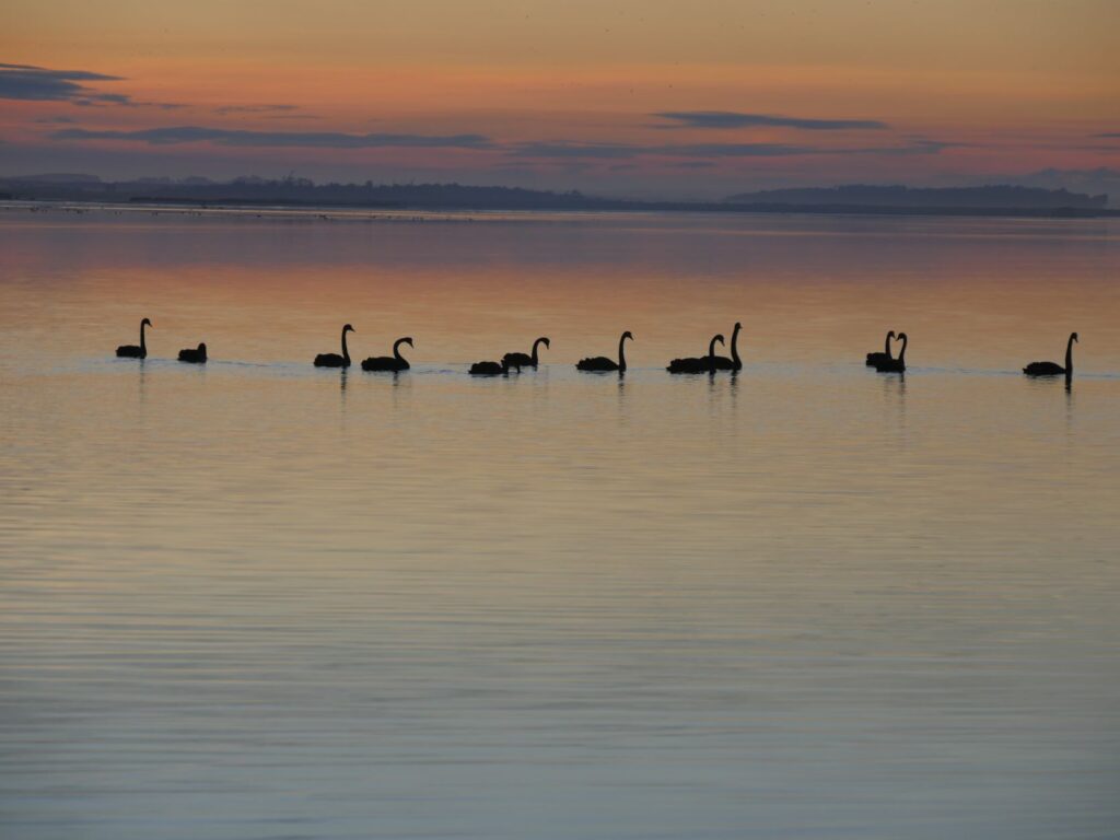
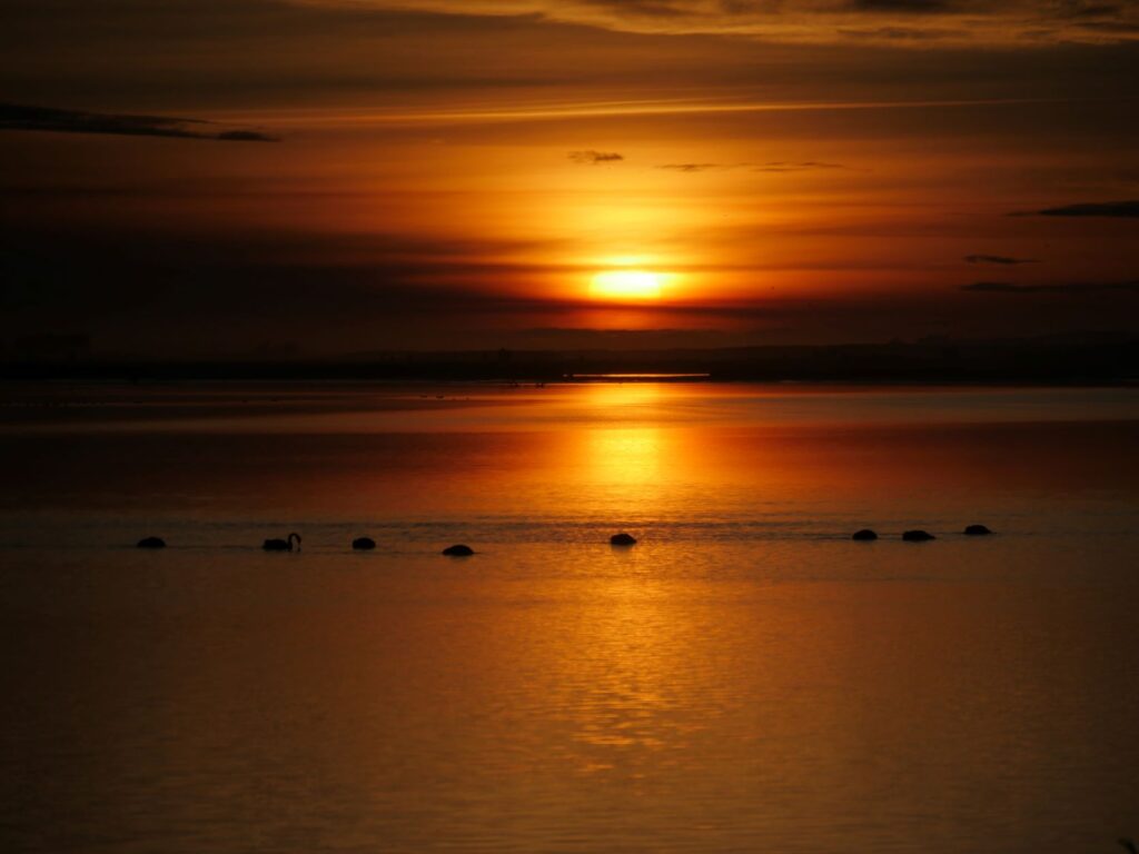
We certainly weren’t disappointed on the first night of our foray in the Catlins, arriving just in time to enjoy the most stunning sunset over a tranquil estuary, populated by a flock of swans. I’ll the let the photos begin the stories of the Catlins!
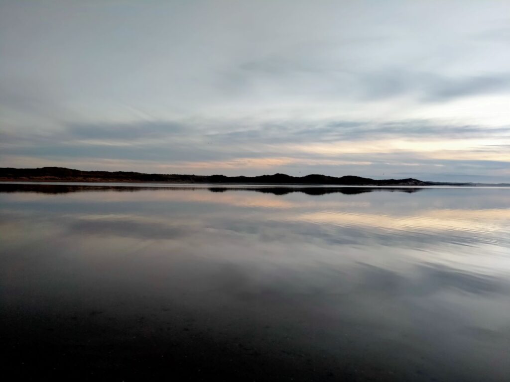
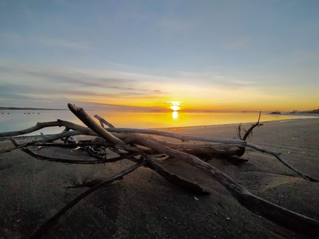
We were up early the next morning and caught the sun not long after it arose, whilst the tide was still low. The shoreline was predominantly formed of rounded stones of varied geology, whereas further out was sandy mud, deposited by the river toward the mouth of the estuary. The low tide enabled us to walk along the estuary edge and Debs in her gumboots could reach the few remains of the wreck of the INO, a steamship which ran aground on the ocean side of the Fortrose spit in 1886. There was no loss of life in this incident and in fact the motor was removed along with the boiler before the unmanned ship, being lighter, floated into the harbour and eventually settled in the mud, where she still lies today. Just a note of caution that it is muddy rather than sandy out by the wreck and Debbie said it was concerning how much she sank into this mud. At full tide this area is fully submerged including the remains
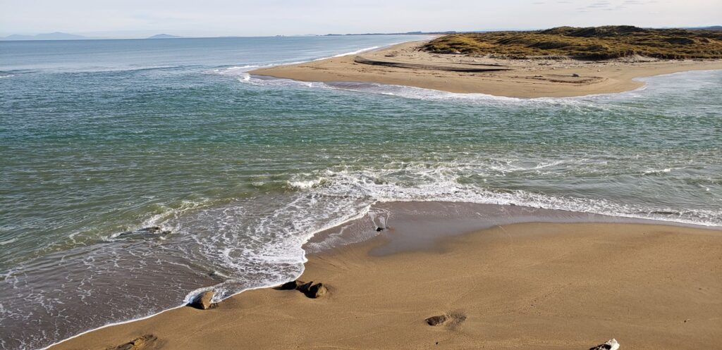
We left our camp location and drove up to the headland overlooking the spit, river mouth, bar and back down the estuary. I would add that our free-camp location on the edge of the estuary was ideal in the weather conditions we experienced, but no doubt is very exposed in adverse weather. We had to park up at the end of the hardstand road on the headland, although it was clear from the deep tracks that others drove on, much nearer to the cliffs. This was four-wheel-drive country beyond the hardstand though. With the slumping of the ground around the cliff edges we kept back, as the edge is not protected and is clearly unstable, steep and a significant height above the shoreline below. Also up the headland to the left of the road on the way up is the nine-hole Tokanui Golf Course. I’m no golfer but the course looked pretty challenging on a good day, with some serious uphill lies.
WAIPAPA POINT
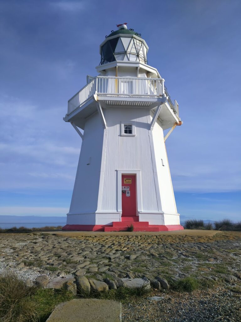
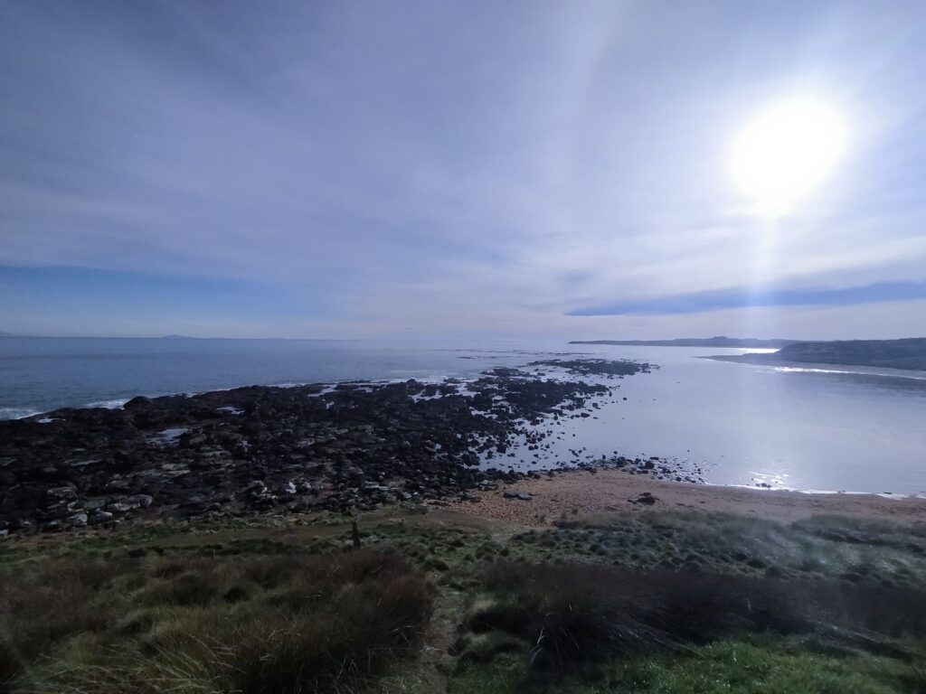
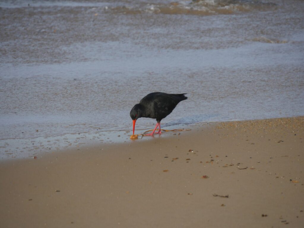
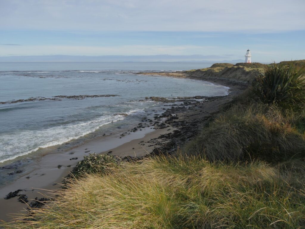
Our next stop after Fortrose was Waipapa Point. Here there is a rocky shoreline and a home to fur seals and sealions commonly, although there were none in attendance that we saw during our visit. The lighthouse here was built in 1883and is still fully operational today, although the need for a lighthouse keeper became unnecessary in 1976, when the light was automated. This lighthouse was the first to be connected to the national electricity grid back in 1943, reducing the need for two keepers to one at that point. During our visit the weather was clear and the sea very moderate. The signs were there though of the commonly described ‘bleak, unforgiving stretch of coastline that challenges all living things’. There was a copious amount of beached and seabourne kelp, which seemed to be keeping a lonely black oyster catcher occupied.
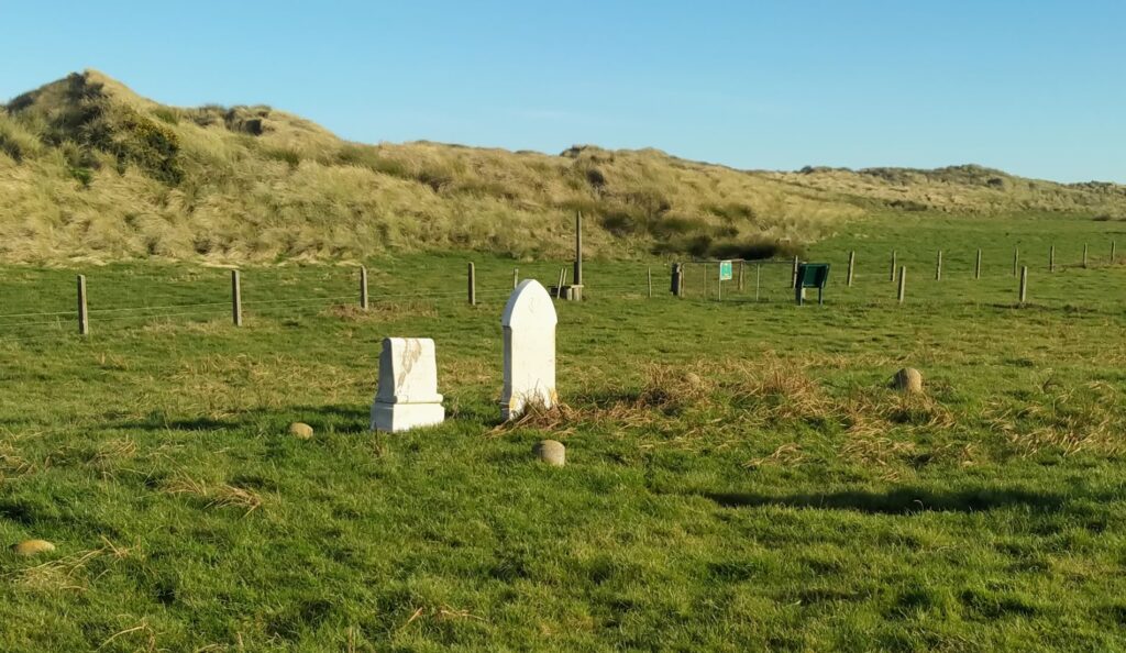
A short driving distance from the Waipapa Point lighthouse and a walk across a farmer’s paddock is the remains of a graveyard that contains the bodies of the passengers of the SS Tararua. This ship, on its way to Bluff struck the reef at Waipapa Point on April 29 1881, in calm seas. At the time passengers held little fear for their safety and one of them swam the 300 yards to shore through the strong undertow to raise the alarm. Unfortunately the rescue ships were to arrive too late and despite several attempts to get passengers ashore there was no success. The seas became heavier and the last cries for help were heard at 2.30am on Saturday 30 April 1881 as the ship sank. Of the 151 passengers on board 131 lost their lives. This is still NZ’s worst civil sea disaster. The plaque indicates that 104 bodies were buried at the ‘Tararua Acre’ site, an area surveyed off for the purpose. There is very little to show for so many bodies lying in this acre today. There is a stone monument and plaque, a headstone erected by the children of Fortrose School, one headstone to victim William Bell and some low cast concrete domes that are perhaps markers of the grave sites. There is one further headstone, but this is for someone who died later in the 1880’s. Whilst we were photographing here it became apparent that this area and the field we had to cross, were completely covered by a blanket of fine spider webs. Never seen anything like it as it shimmered in the sun. We only saw one small spider on inspection, but surely he wasn’t working alone!
SLOPE POINT & WAIKAWA BAY
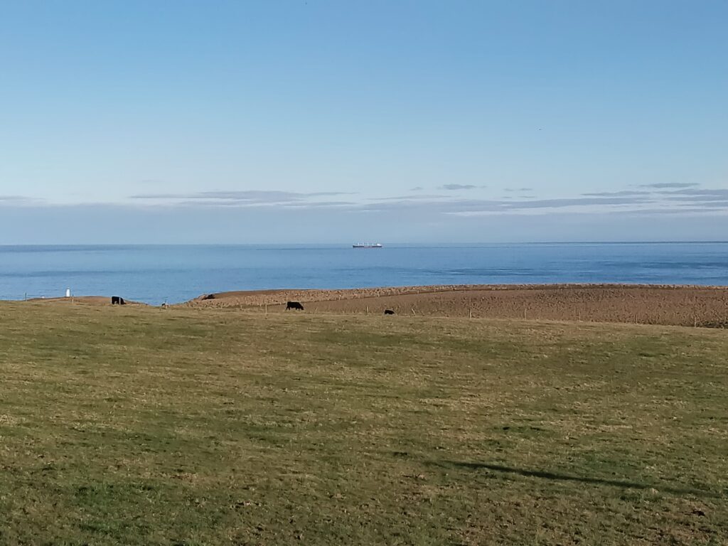
Eastward we moved and deeper into the Catlins toward our night stay location of Waikawa Bay. The Catlins has so many places and features to see on the way between ‘towns’, it was always uncertain whether we would make our intended stayover destinations. We did in this case, although we did detour down to Slope Point, the southern most spot in the South Island. We stopped at the carpark to the Slope Point walk and after some reconnaissance and deliberation did not take the walk. A large muddy field occupied by some friendly but inquisitive looking bulls confronted us, with a sign on the gate that stated we were to ‘enter at our own risk’ as the area contained animals. After a previous altercation with a bull on the Hauraki Rail Trail in the North Island, we weren’t prepared to venture further considering you can’t outrun a bull and the paddock escape route over the electric fence didn’t excite us either! Debbie took photos of the bulls and a long shot of Foveaux Strait in the distance and we left, half ticking the box that we had reached this southernmost milestone.
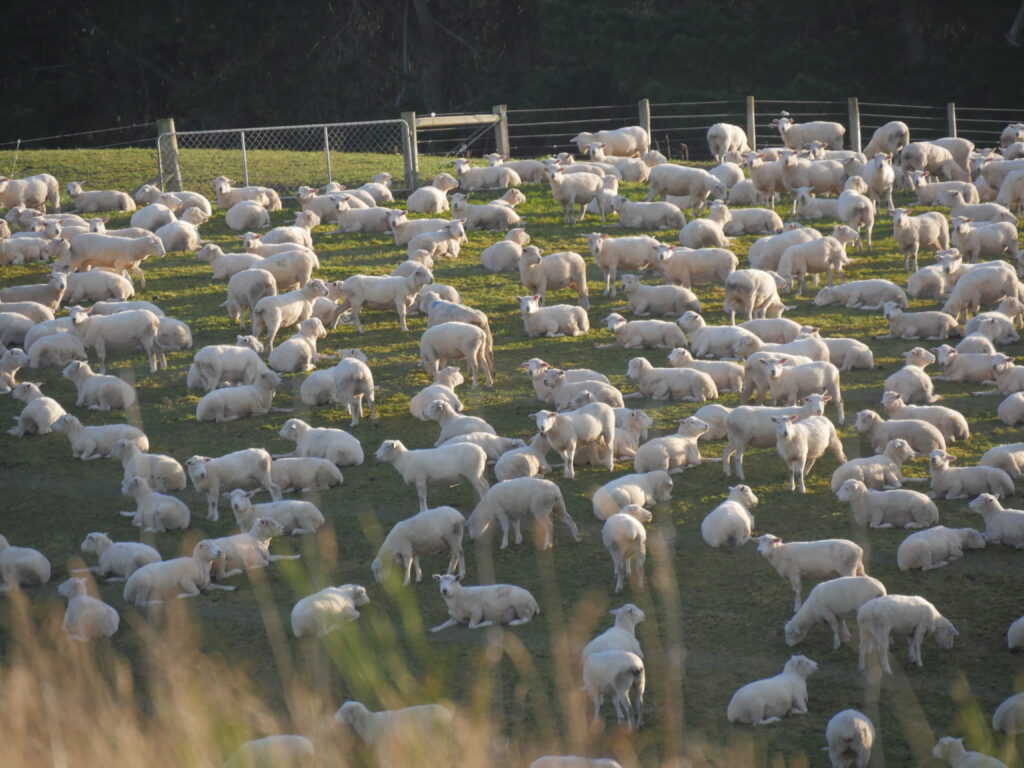
After leaving Slope Point we headed straight for Waikawa as the sun was sinking fast. We stopped briefly where I think an attempt was being made on the Guinness Book of Records “most sheep in a paddock’. We also stopped at Haldane Bay and shot a few photos of the glassy waters from the gravelly section of main road opposite the bay, where it appears a ford may form on occasions.
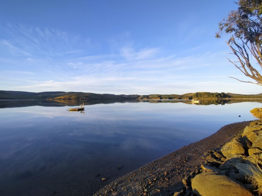
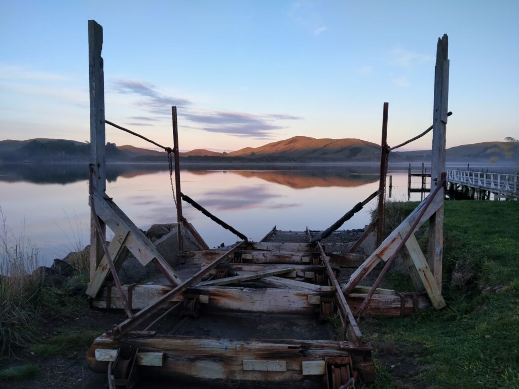
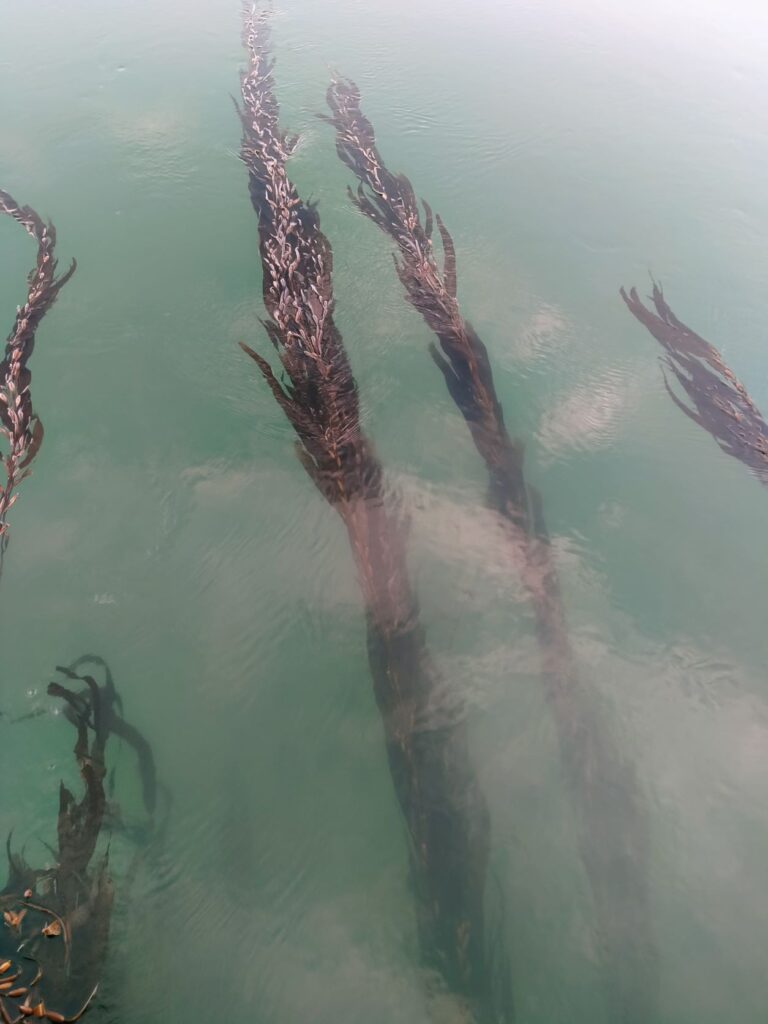
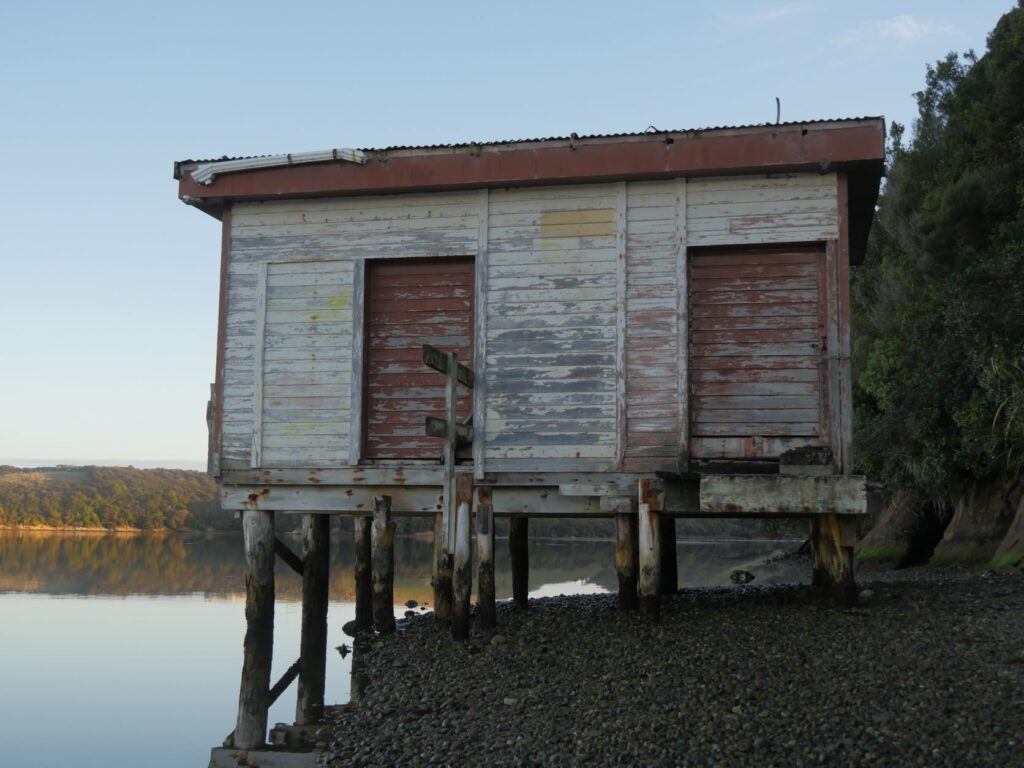
On arrival Waikawa Bay was presenting spectacularly in the sunset. The aging and rustic wharf, together with the adjacent weathered and ill-maintained elevated boat-shed(?), were a stark shadowy contrast to the reflection of hills and clear blue sky on the gently flowing waters of the bay. This was truly a NZ waterfront mercurial scene with those remnants of historical makeshift structure defying time and getting their moments of artistic glory, never imagined at the time of construction for pure practicality. As the water drifted lazily toward the ocean the kelp caught around the wharf piles danced in the water like a flowing veil. Historically like many Southland towns the port here was once very busy up until the 1920’s when shipping ceased. Prior to this it was a major port for shipping timber, but because of ‘silting-up’ Fortrose became more prominent and Waikawa Bay declined even further with the arrival of branch railway.

CURIO BAY
The weather deteriorated on 10 May and we awoke to uninviting rain and wind at Waikawa Recreation Reserve free-camp, which was thankfully a hardstand area behind the local hall, with toilets. Still, we had a schedule to keep and headed for Curio Bay, donning all our wet-weather gear to visit this southern coast bay being lashed by squalls. Instead of parking near the visitor centre/café we stopped in the public carpark nearer the headland.
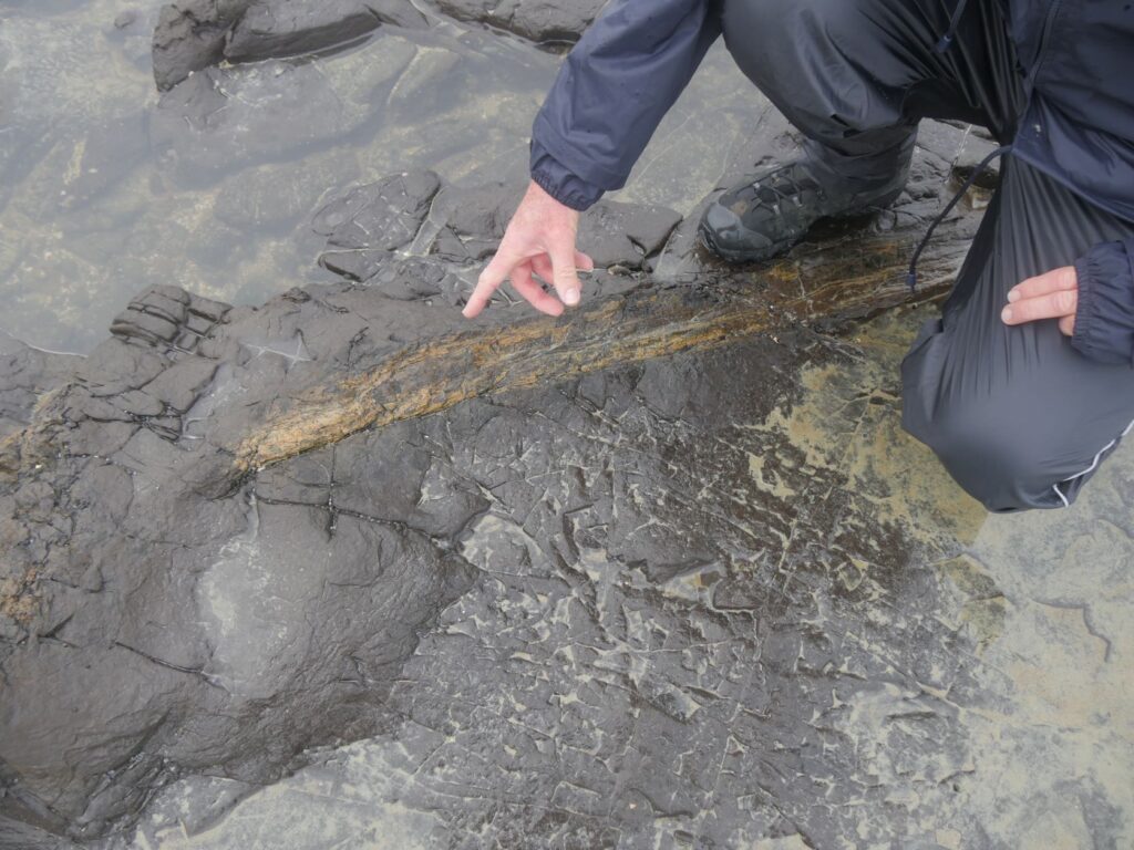
It was a bit of a walk to finally locate our target; the petrified forest. We foolishly hadn’t even bothered to check the tides and we were very fortunate that it was low and the fossils on show here were fully exposed. The rain had abated by the time we descended the well constructed staircase to the rocks, but the wind was still sending waves crashing onto the furthermost outcrops. However, you didn’t need to venture far out from the bottom of the stairs to see the impressive fossilised fallen trees and trunks, solid stone for 170 million years. The trees, according to scientists, turned into stone in a matter of months when impregnated by silica rich floodwaters from volcano runoff laden with ash. Years of pounding by the seas have worn away the upper layers of soil to expose the fossils.
These rocks are also home to the rarest penguin in the world, the Hoiho, or Yellow-Eyed Penguin. Apparently there are three that live here permanently, but they leave the land at dawn and return just before dusk. As usual we arrived too late for the dawn viewing and couldn’t wait for their return.
After our time at the ‘Jurassic’ forest we were in need of a hot drink and sustenance, so retreated to the café. Herein also lies the CurioScape interactive museum, which we could view for a small donation since we had purchased brunch at the café. This was an extremely worthwhile experience which took us around an hour to view. Items of note here were:
- An interactive map of the Catlins highlighting all the major points of interest;
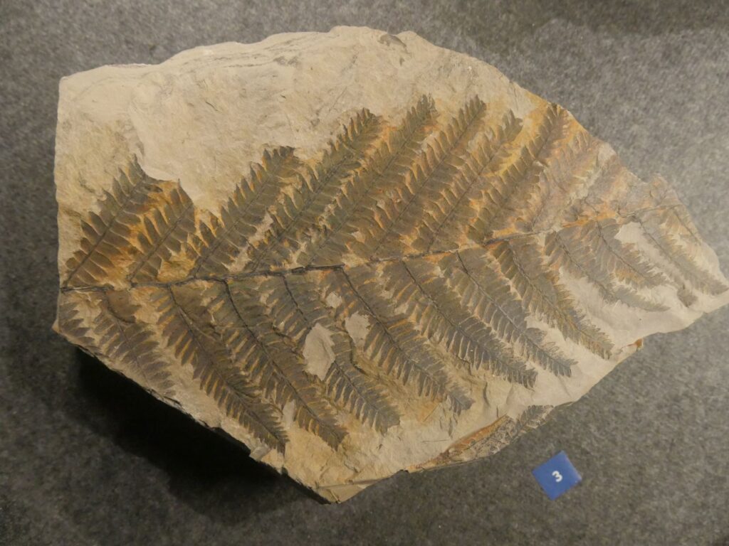
- Touchable examples of petrified tree stumps, ferns and tree trunks in their stone matrix;
- An interactive history of the formation of the petrified forest;
- A history of the formation of New Zealand geologically from 220 million years ago, showing the breakup of the continents;
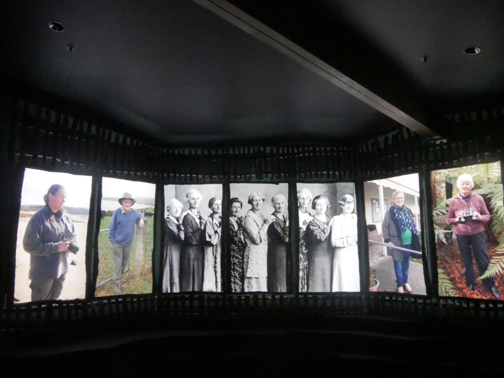
- A cinematic presentation of the formation of New Zealand including excerpts from Maori legend through to European colonization; the impact of the various occupiers of this land and initiatives underway to restore environmental balance.
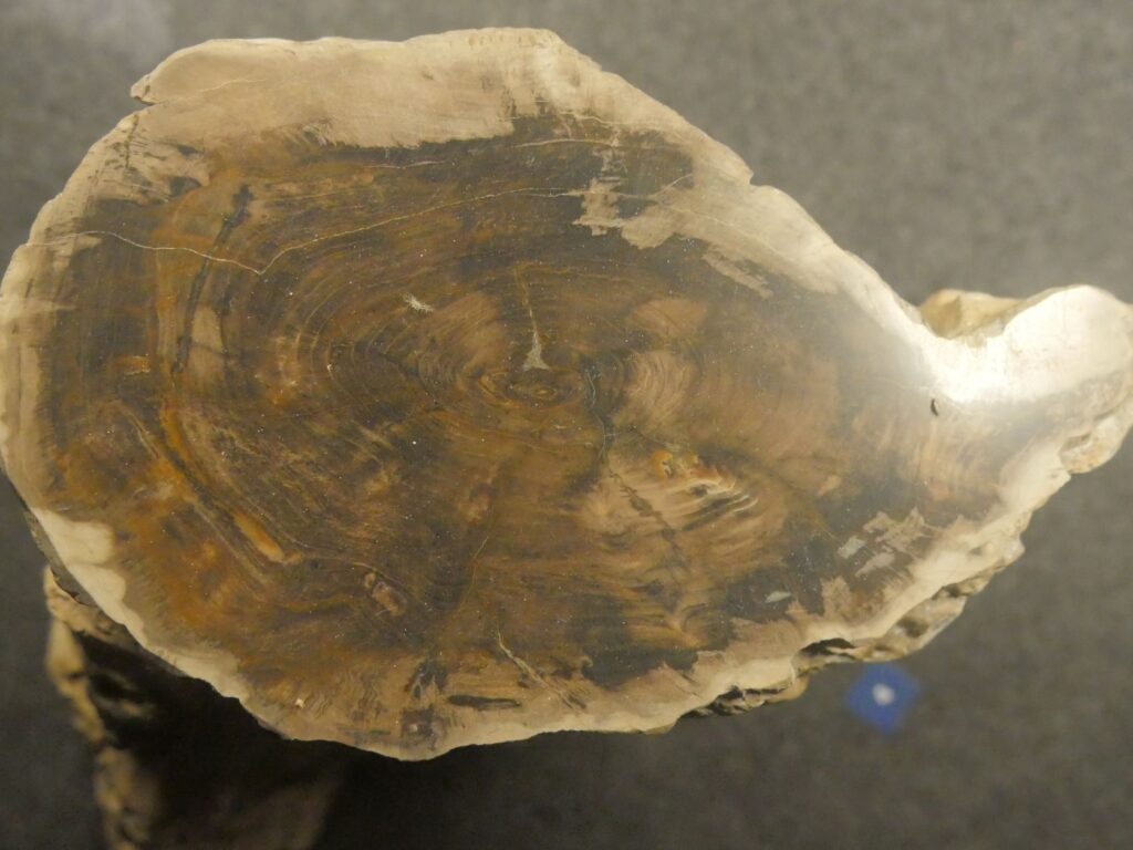
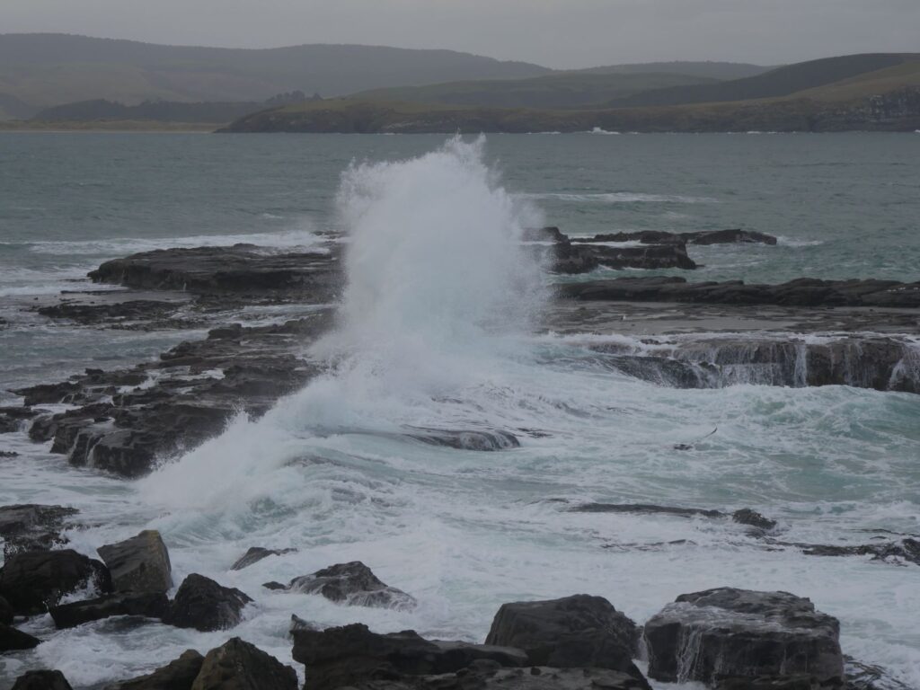
After feeling diminished as an individual in the scale of NZ’s creation, we ventured out onto the rugged headland. The waves were impaling themselves on the rocky outcrops, leaving waterfalls cascading down the tiered faces as the wave receded. Cormorants sat atop granite pillars preening themselves as the waves battered the cliffs beneath them. Swathes of kelp swam in the constant ebb and flow of the waters, with much being lifted and eventually stranded on the rocky shore. Here is a place where history is laid bare and the constant movement never ceases in reshaping the landscape. We spent around 3.5 hours here in total before moving on to the Koropuku Falls.
KOROPUKU FALLS
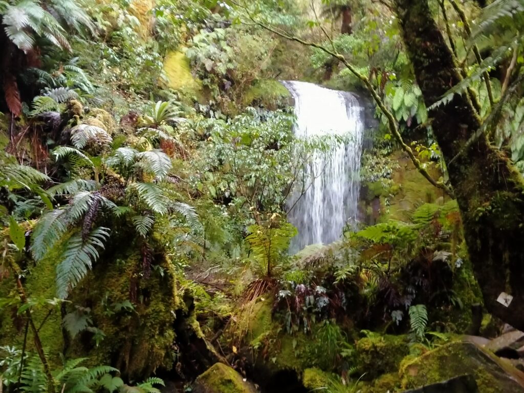
The walk to the falls, which takes around 20 minutes excluding photo stops is relatively straight forward, the path being overladen with transverse punga logs for stable footing in many places. The track proceeds through a luxuriant native forest, with careful footing required over the last few metres as you traverse damp rocks and a crude single timber plank bridge supported by two waratahs as hand-holds. It had been raining prior to our visit and the route to see the pond directly below the falls looked treacherous, so we took our photos just prior to the pond. These ‘curtain’ falls cascade about 10m and thanks to the rain had a good flow while we were there. Definitely a worthwhile walk through the native forest resplendent in various ferns and mosses.
PAPATOWAI DOC CAMP
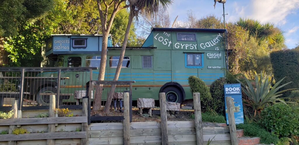
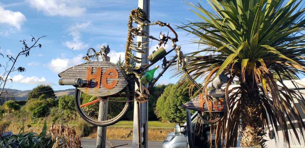
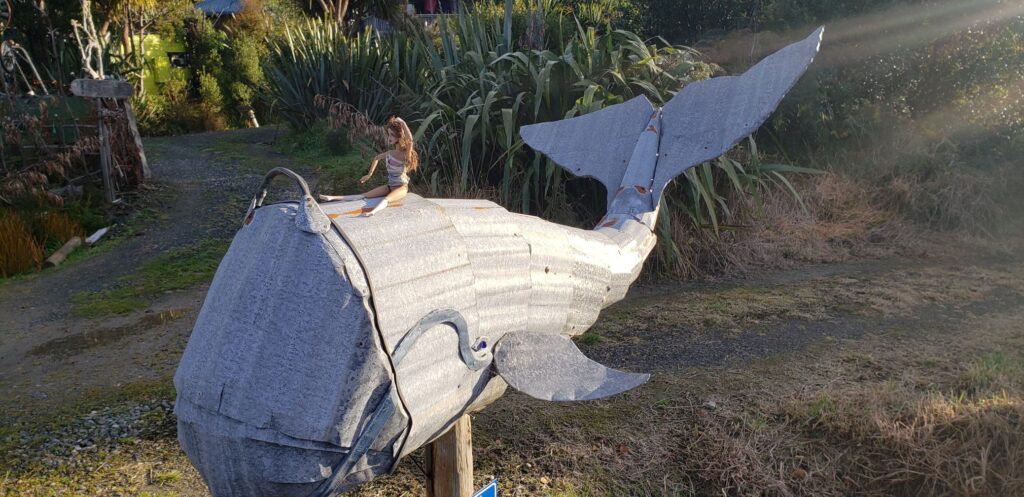
Our stayover on the night of 10/05 was at Papatowai DOC camp, which was deserted except for one other campervan. It was wet so we chose a hardstand site – there was a lot choice but most sites were on the grass. We had stopped at ‘The Lost Gypsy Gallery’ just prior to arriving at the camp, but unfortunately it was closed. Debbie shot some photos anyway to highlight the eccentric creations that exist here.
The camp provided direct access to the estuary leading out to Tahakopa Bay. We were fortunate again that the evening was still, particularly after the start to the day and the sky a dusky blue, providing an extremely peaceful scene and resulting mirrored images on the estuary. We were learning that the weather down here was extremely changeable.
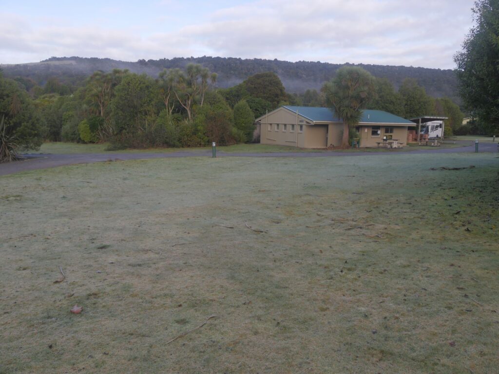
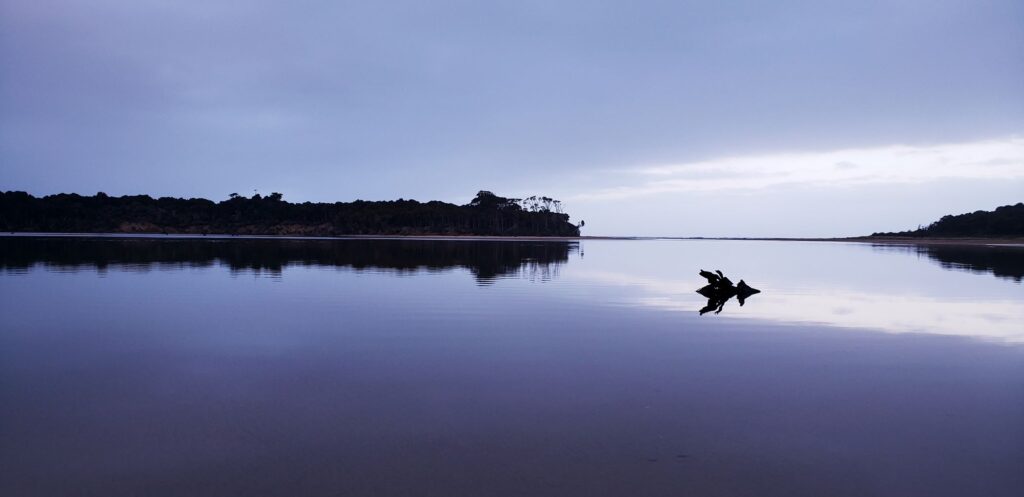
The motels, store and service station at the entrance to the camp were all closed. The camp itself had flush toilets, a rubbish skip and an amenity block including a kitchen with sinks, but no other equipment, appliances or utensils. There was no potable water here. We boiled the tap water from the kitchen as directed but it sill looked unpalatable to us. There were some outside tables and chairs, but it was far too cold for us to use them and they were damp anyway. I can imagine that it is a camp that would be heavily populated by beach-bums and holiday-makers in summer and infested by sandflies, as many locations near water are down here.
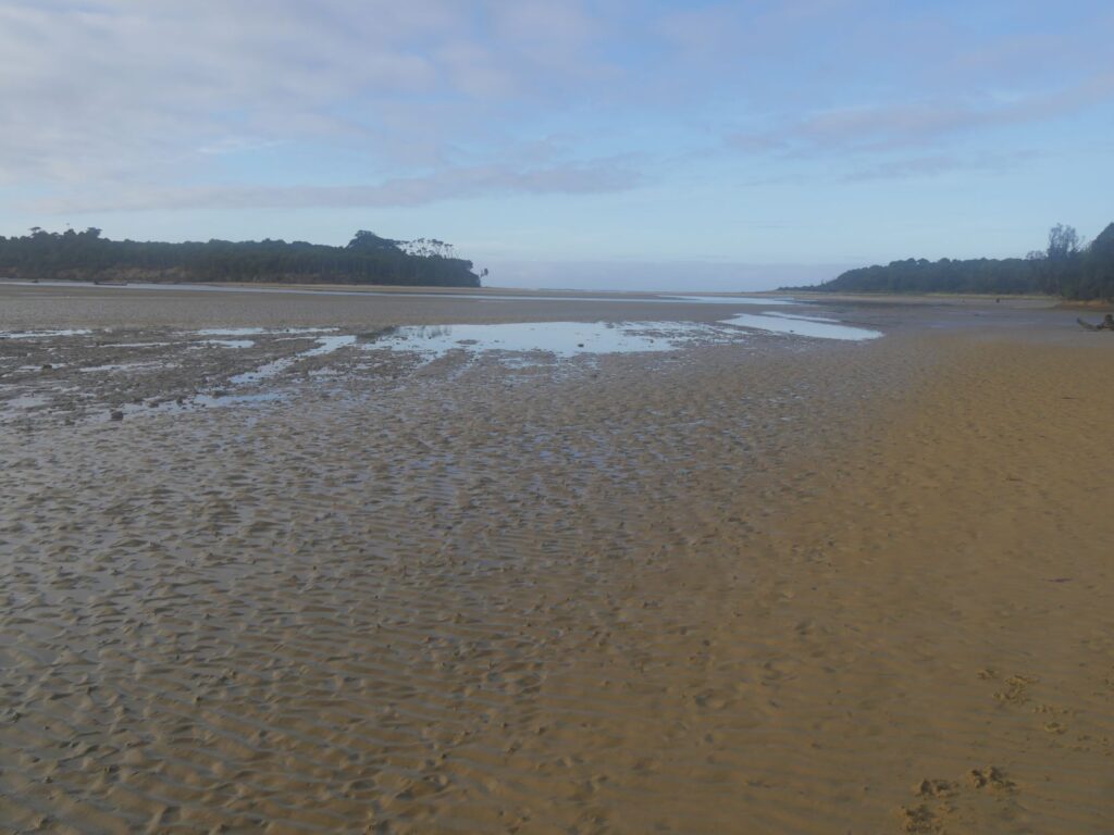
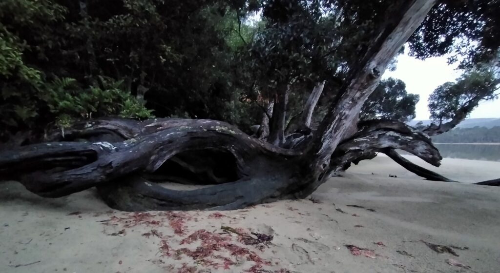
We stayed the one night here waking to a very frosty morning with nearby puddles frozen over. We took another walk down to the estuary, which was almost entirely bereft of water, as the tide was well out. Came across a couple of locals who had had obviously lived here for some time (see photos below). We had much to see today again, so exited early leaving the camp deserted, since the ‘slidie’ had departed before us.
PAPATOWAI TO PURAKAUNUI BAY
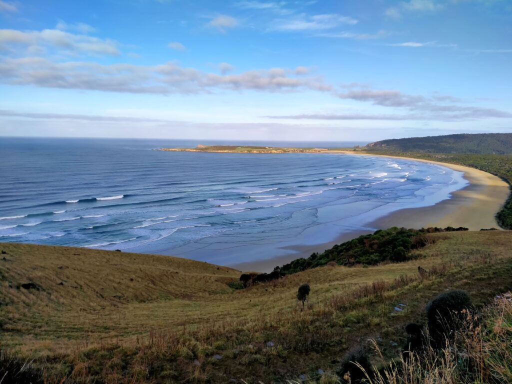
Our first stop of the day (11/05) was Florence Hill lookout, just southwest of Papatowai. This overlooks Tautaku beach and peninsula, where the waves were rolling lazily in under a clear sky. There was little wind, but it was nonetheless cool after last night’s frost. An information board advised the average temperature here is 11degC ranging from -9degC to 30degC. Rainfall around 1200mm per annum is the same as Auckland. The only mention of wind was that it was ‘ever-changing’! The beach is completely forest fringed and appeared blemish free of rocks, driftwood and kelp. Direct beach access is available to four-wheel-drive vehicles and these factors, plus the huge swells that can drive up from the southern ocean, make this a popular surfing destination. It is nonetheless remote and fur seals, sealions and yellow-eyed penguins frequent this bay, along with the occasional whale. We saw none from our high vantage point however and didn’t have time to venture down into the bay.
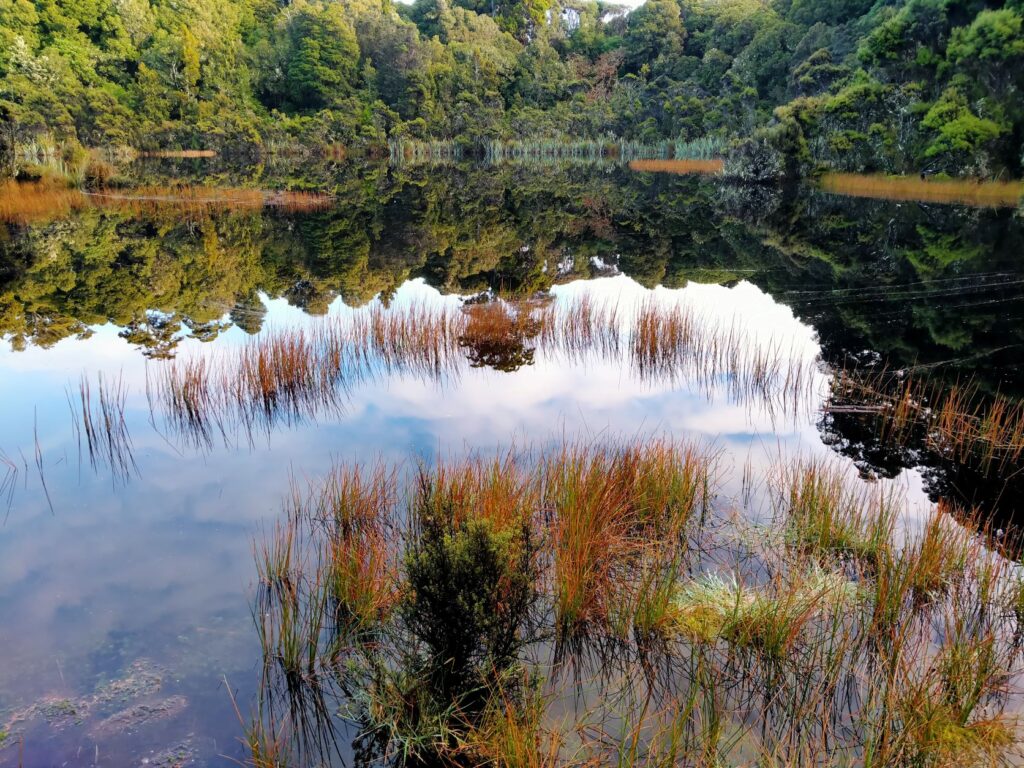
Next stop was Lake Wilkie, about a 30 minute return walk from the road. The lake was formed by water trapped in a depression between ancient sand dunes and a cliff. However it is diminishing in size and is called a ‘bog lake’, brown in colour due to organic acids released by the peaty soils. It was an easy walk to the lake with excellent viewing from the boardwalk at the lake edge. Information boards along the track explain the zones of fauna visible here. The podocarp forest with the native Rimu and Southern Rata was lush with crown ferns, whilst the lake was still and reflecting clearly everything above the surface. One day sadly the lake will cease to exist, but in the meantime we would recommend the walk!
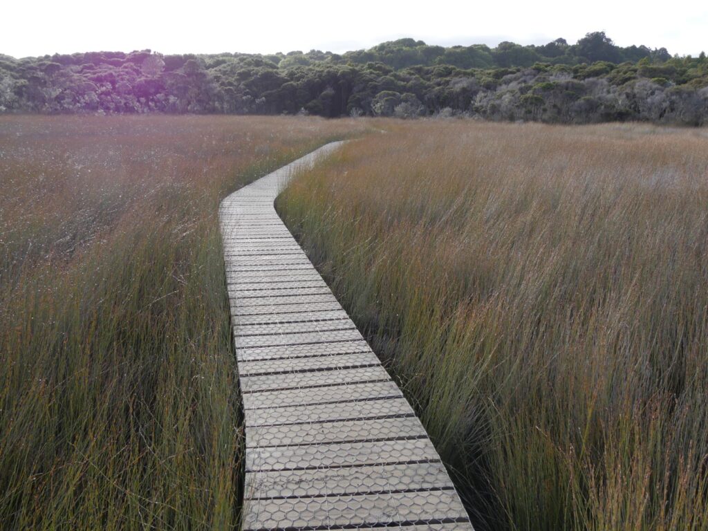
Onward we went to the Tautuku Estuary boardwalk, another which is about 30 min return from the carpark, always dependent on the number of photos you take and information signs you read. Another easy walk with an old sawmill location en-route to the boardwalk. We couldn’t see any sign of mill remnants through the ferns and bush in the area of the sign. Maybe there actually weren’t any remains? The boardwalk takes you through a massive field of ‘jointed rush’ and out to the viewing platform. The area is home to the ‘fern bird’, described as a shy sparrow-sized bird that is a reluctant flyer. It was certainly both those things as we didn’t see any sign of it here. Instead Debs resorted to spider web droplet photos for creative impetus. The exposed gnarly roots of the trees on the bank beside the forest section of the walk were a rarely seen subterranean cross-section.
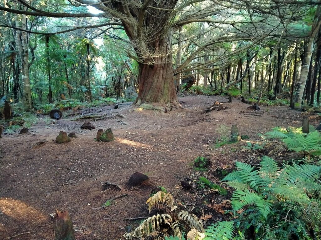
At the beginning of the walk there was a boggy path leading to what the sign suggests is the ‘1906 Pioneer Home’. We braved the wet and muddy track ploughed into furrows by vehicles, but only located a piece of an old concrete slab and part of an abandoned aging corrugated iron tank. Not sure if this was what we were supposed to identify as the home, as there was no further signage. I delved deeper into the forest, which was notable for the mature native trees but still found no sign of a home. The varying features of the Catlins continue to roll out like some geography field trip.
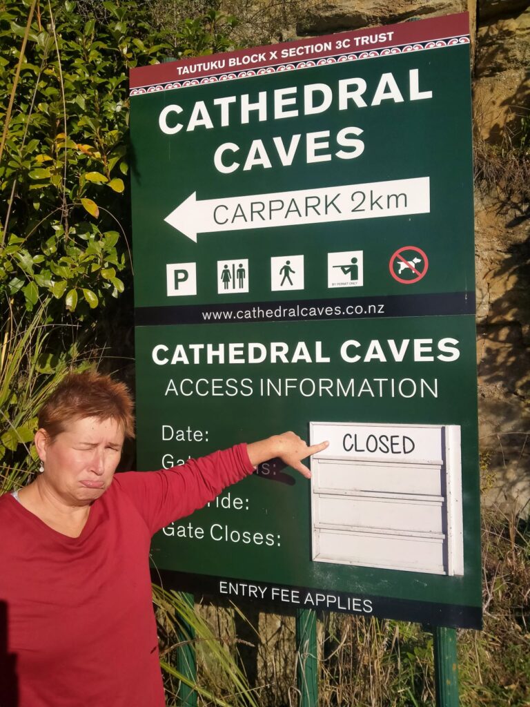
Sadly at our next stop we learnt the drawbacks of travelling in the winter. The much lauded Cathedral Caves was closed for the winter months. We had heard that, but went to the entry gate as we were passing any way, to verify it for ourselves. Disappointing, but just another reason to return in the future.
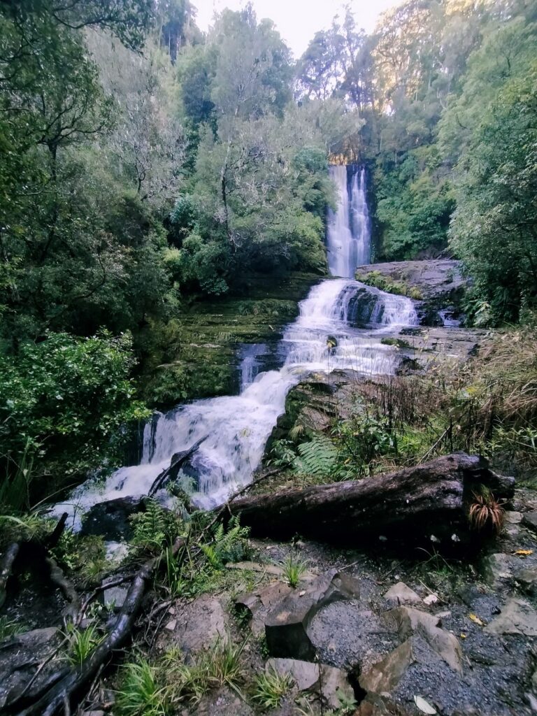
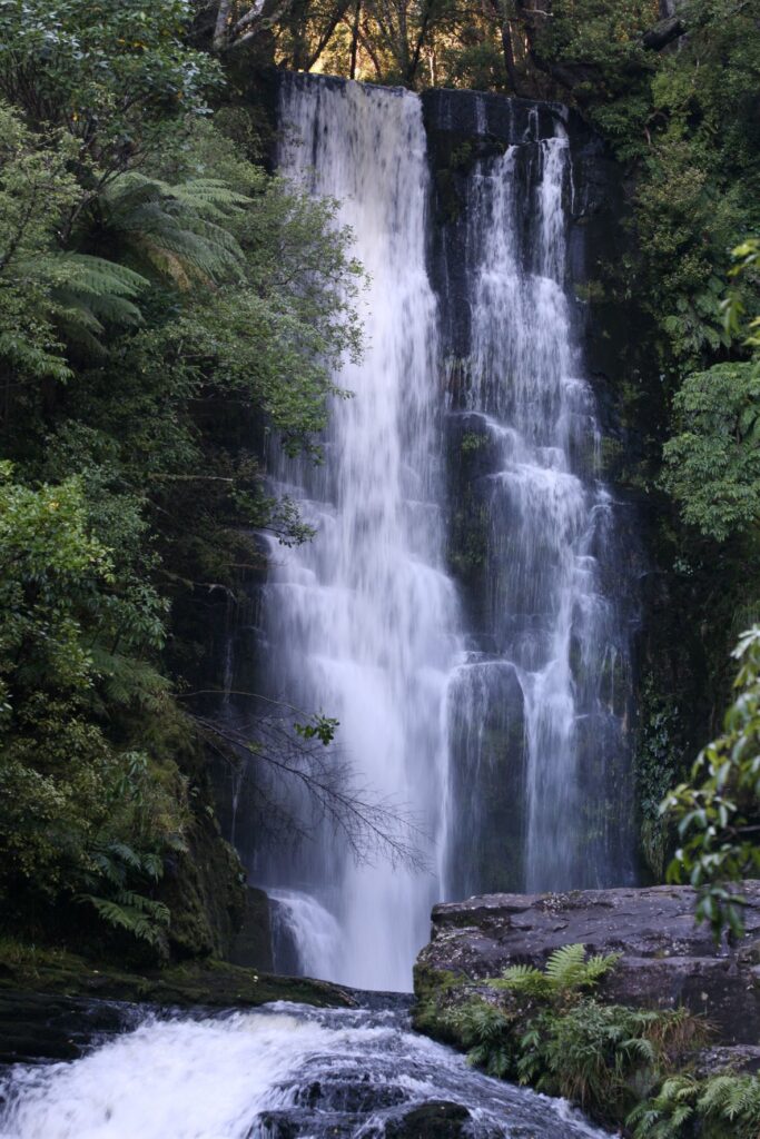
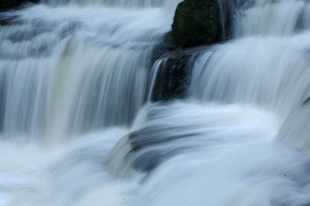
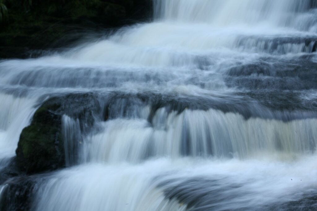
There was still much to see though and our next stop was the McLean Falls, a 40 minute return walk through more DOC native bush. There was a tinge of precarious adventure near the last part of the walk where the “don’t stop falling rocks’ signs prompt you past an overhanging rockface of dubious stability. Clearly slips have occurred here in the past and you ask yourself if it’s been raining a lot recently. The falls themselves are 22m high and a must see. The water of the Tautuku River cascades over layers of rocks and away down the ‘Chute’, which is a water-race come waterfall itself just below the main falls, but not as visible. It was time for Debbie to pull out all her photography experience, to enhance an already stunning sight and capture that inimitable effect of ethereal movement. I did some Slo-mo video recording of the scene to capture some footage for later production! Check out “Going with the Flow” in our music section.
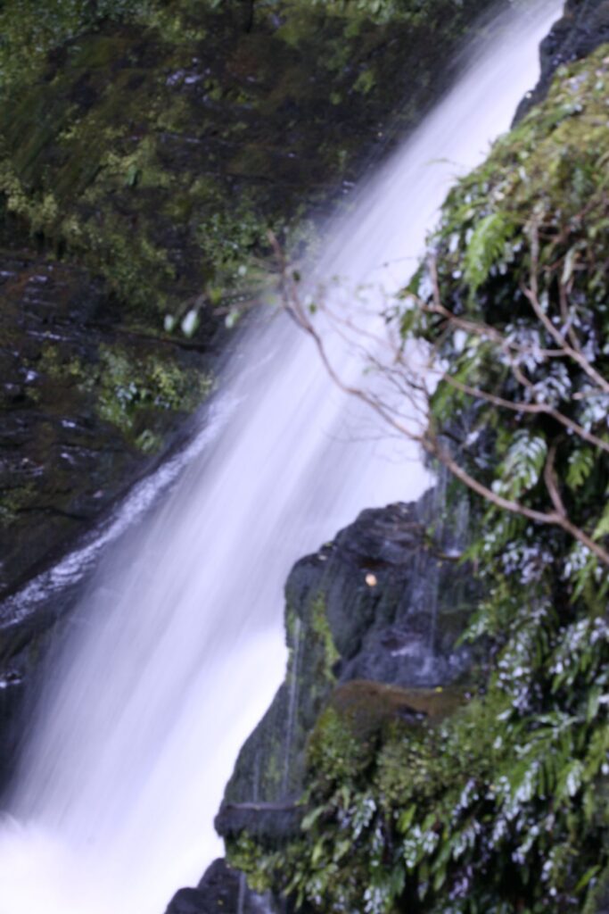
The day was still far from over and it was the Matai Falls next. This is a 30 minute return walk, with a further 5 minutes onto the Horseshoe Falls. In reality most of these walks and waterfall viewings took us at least 30 minutes longer than the prescribed time on the carpark signs. Both the Matai and Horseshoe Falls were not as impressive as the McLean Falls, albeit slightly different in formation. Nonetheless they were still worthy of a visit and continued the full immersion in NZ’s native wonderland. It astonishing how much natural splendour is able to be viewed in just few hours. On the walk back from the falls we took the detour to view the Catlins Branch Railway Walking Trail. We didn’t have time to walk the trail, which required another hour to complete as the day was drawing on, but it highlighted again that despite what we saw there was still much left unseen. The photos below depict the Matai Falls on the left and Horseshoe Falls on the right.
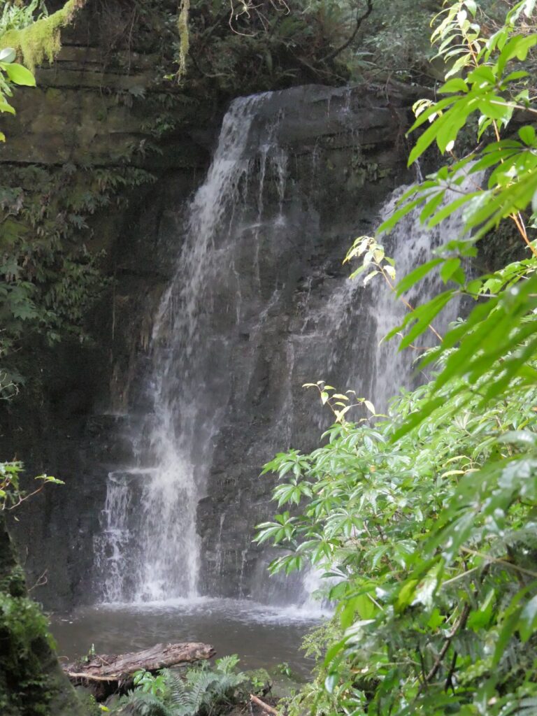
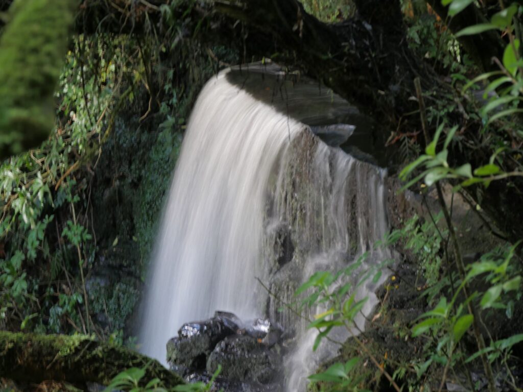
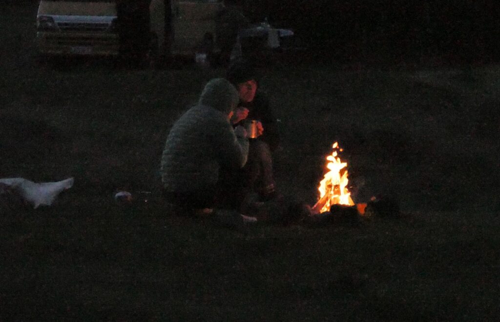
The final drive of the day took us to a remote Purakaunui Bay and it was nearing darkness when we finally arrived. Despite the isolation there were a number of ‘slidies’ in attendance, occupied mainly by what appeared to be surfers. We managed to get a few photos before the darkness completely enveloped the bay, although one young couple suitably rugged up had a campfire burning and were sipping on mugs no doubt containing warm fluid of some description. The fire provided a glow characteristic of the camps of our young days. Full body wetsuits hung outside one van, but I was sure there would be no further drying for those during this night. The last of the ‘day surfers’ left the camp and most of the night campers retreated to the warmth of their vehicles as the temperature plummeted. This would be a welcome reward no doubt for bracing what looked to me like a savage surf break in very cold and uninviting waters. Despite the holistic beauty of the bay, surfing here at this time of year was seriously hardcore in my opinion and I would never have contemplated that at any time in my life! I will applaud those that do.
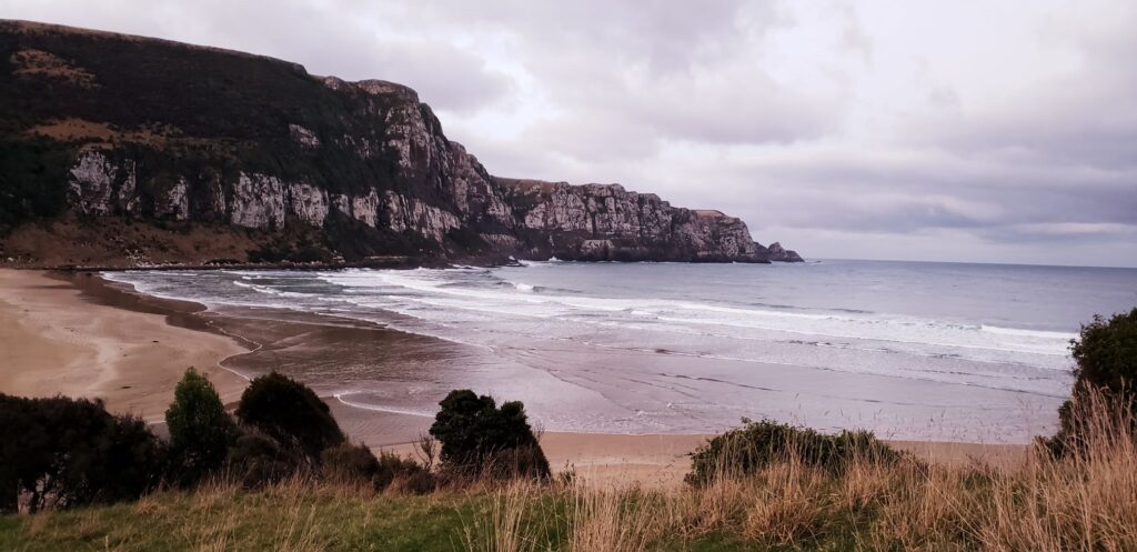
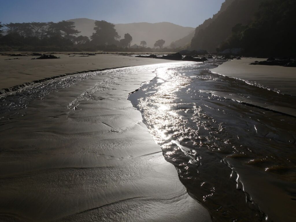
Debbie was up at dawn the next morning (12/05) in search of something photographically magical in the sunrise. I followed soon after. The scene was one of beauty and the beast. The surf was ominous with spray whipping off the crest of the breakers, the waves then calming and ambling toward the shore where it licked the rock outcrops and coated the smooth sand like resin, to reflect the light of the dawn.
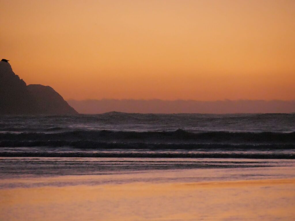
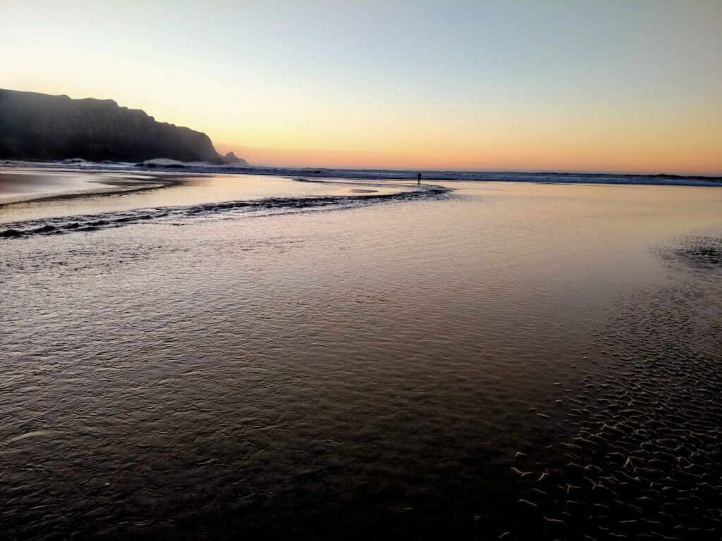
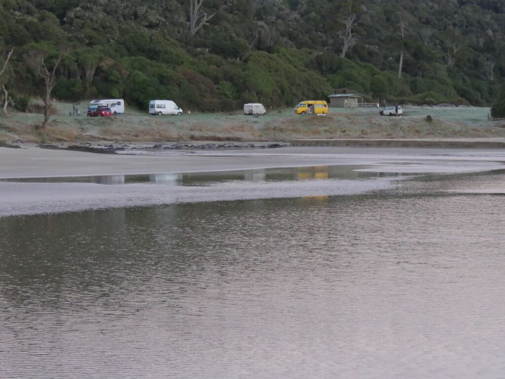
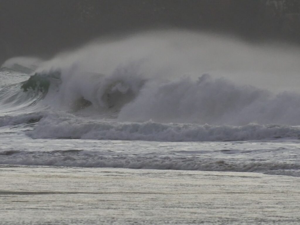
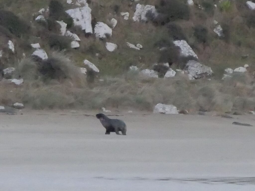
At the outlet of the Purakaunui River a circular sand bar had been created with small vertical sides on the perimeter. It appeared almost as a stage surrounded by a moat. The cast of one eventually arrived in the form of a sealion slowly making its way up the beach but, as they do, shying away from the limelight and remaining ‘backstage’
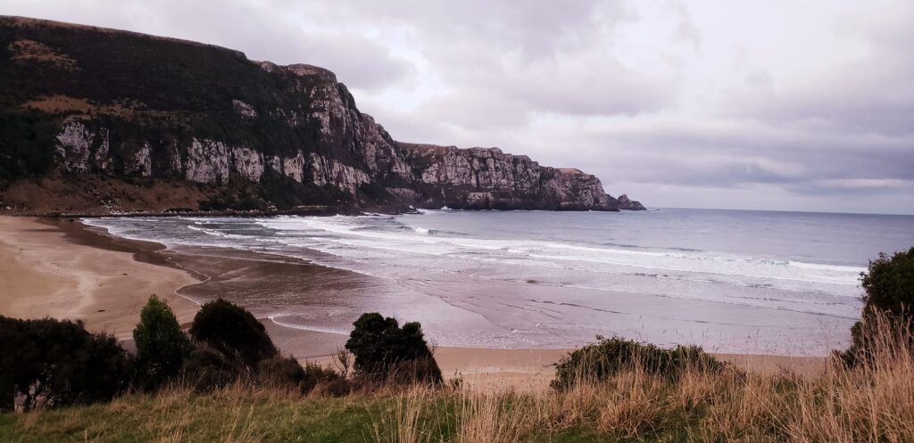
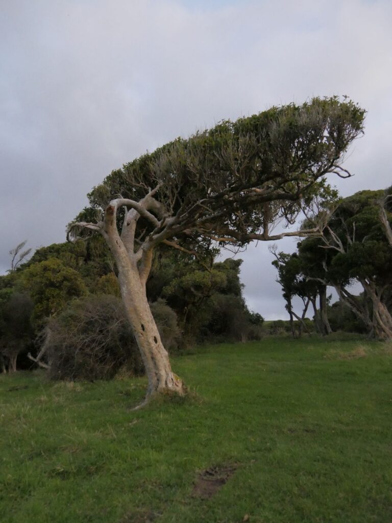
The road to the camp continues a short distance beyond the camp, taking a steep rise to a vantage point overlooking the bay. This affords some good views over the bay. The banks contain trees that tell a story of the ferocious winds that batter the bay and rise up the surrounding hills.
PURAKAUNUI BAY TO NUGGET POINT
After ‘milking’ the beauty of the sunrise and downing another cereal breakfast it was time to move into what would be our last day in the Catlins. It had dawned with a very heavy frost, causing the water in the potholes around our wagon to become completely frozen. As we drove out of the bay and through the adjoining farmland the shaded areas along the roadside and in farm paddocks were icy white and the roads similarly. We took the drive slowly because of the treacherous icy conditions as we headed for yet another waterfall. It was becoming like the cathedrals of Europe, “Oh no not another one”.
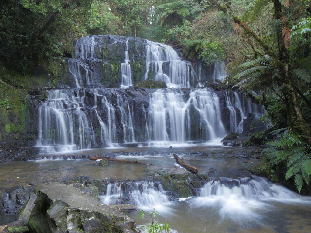
From the carpark it is a 10 minute easy walk to the Purakaunui Falls on mostly gravelled surfacing through native forest. The falls themselves are around 20m in height and cascade over three tiers, but are wider than the McLean Falls. It is described in some literature as ‘NZ’s most photographed falls’ and there were a number of visitors when we were there on 12/06/21. We spent about an hour here as Debbie experimented with various shutter speeds to get some notable photos. There was a photographer on the track working to get a truly memorable shot of the river and forest so we thought. On closer inspection he was using artificial lighting and and a cherry tree branch ‘prop’ unrelated to the fauna here. Of course creativity is not necessarily reality and I shouldn’t really wonder why the ‘point and shoot’ attempts off my cellphone never quite meet the professional level! The falls were iconic given their width and quintessential cascade over natural rock benching. Fortunately once again we had had enough recent rainfall to provide a steady flow over the falls and down the Purakaunui River (see photo right).
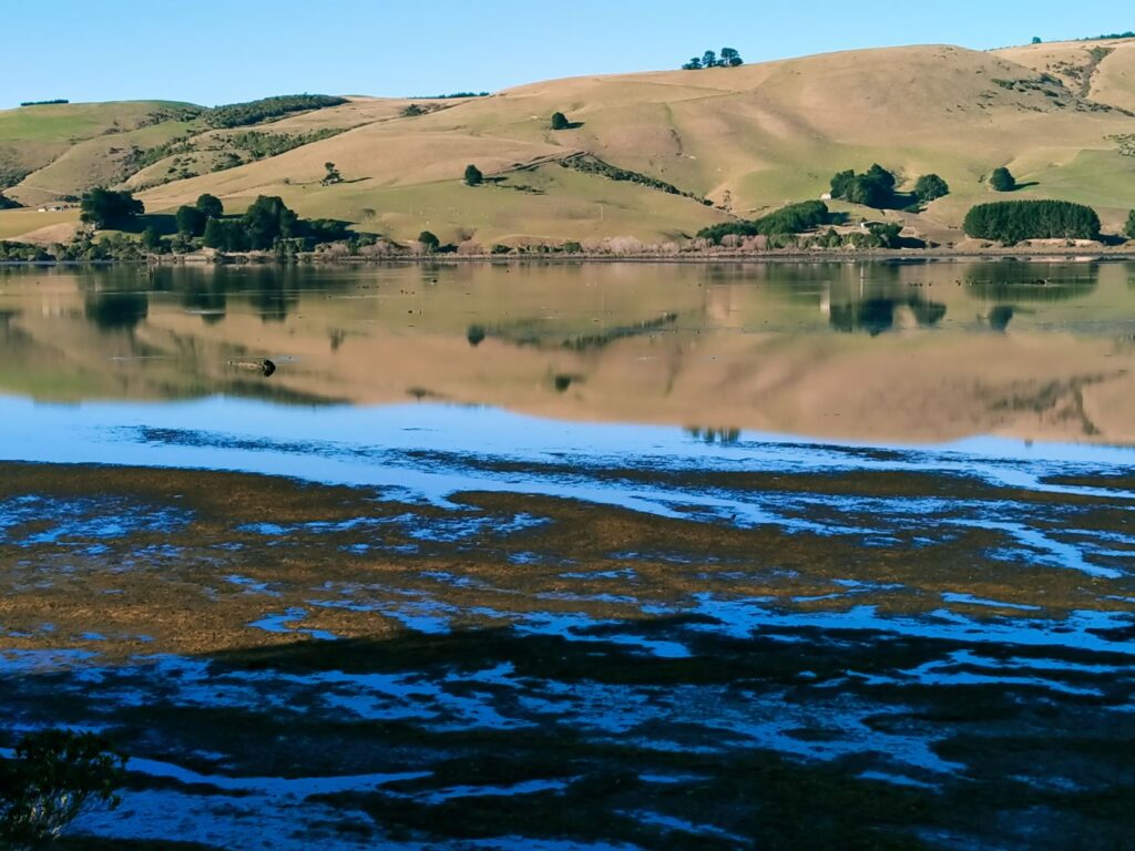
No time to beat about as it was off to Catlins Lake. It was just a quick stop here for a couple of photos. Geographically Catlins Lake is actually the upper estuary of the Catlins River, so is tidal. Part of the lake was offering reflections of the landscape while the saturated mudflats mirrored the sky in a completely contrasting ‘nuclear fusion’ effect. Despite the fact that clearly the tide was not full there was considerable scenic artistic merit on this stunningly clear sunny morning (see photo below).
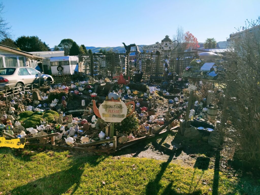
We next called into the township of Owaka and stumbled upon another of those ‘Op Shops’, where it was a struggle to discern if it was a retail shop or museum (probably both) and therefore what was actually for sale. It’s always embarrassing to ask too! There was the usual array of novels and antiquated non-fiction, LP records, vehicle registration plates, hubcaps, a BSA and Royal Enfield motorcycle and a window display featuring an old pushbike, the bottom half of a mannequin, a selection of exotic carved heads in various mediums (some hideous) and the proprietor’s two cats, one of which was suffering from arthritis. A shop of oddities. The proprietor actually motioned us across to her display of homemade soaps of various local fragrances. This was her actual claim to fame. Still she gave us some semi-useful directions and we went on our way typically empty handed. We did take a couple of photos at ‘Teapotland’, which resides in a house down the road, but skipped the full tour so we could justifiably avoid the donation box. We also missed the museum although the Op shop we saw was a pretty good attempt at that!
Our next port of call was Surat Bay, which was another fleeting visit and we only went as far as New Haven (see map below), which is the start of the walk around the bay. Located on the eastern side of the Catlins River mouth it is a very popular beach for sea lions. It has a very informative sign explaining clearly the difference between seals and sea lions, which was useful for us North Island townies. We didn’t venture down onto the beach and couldn’t see any sea lions so moved on to Cannibal Bay.
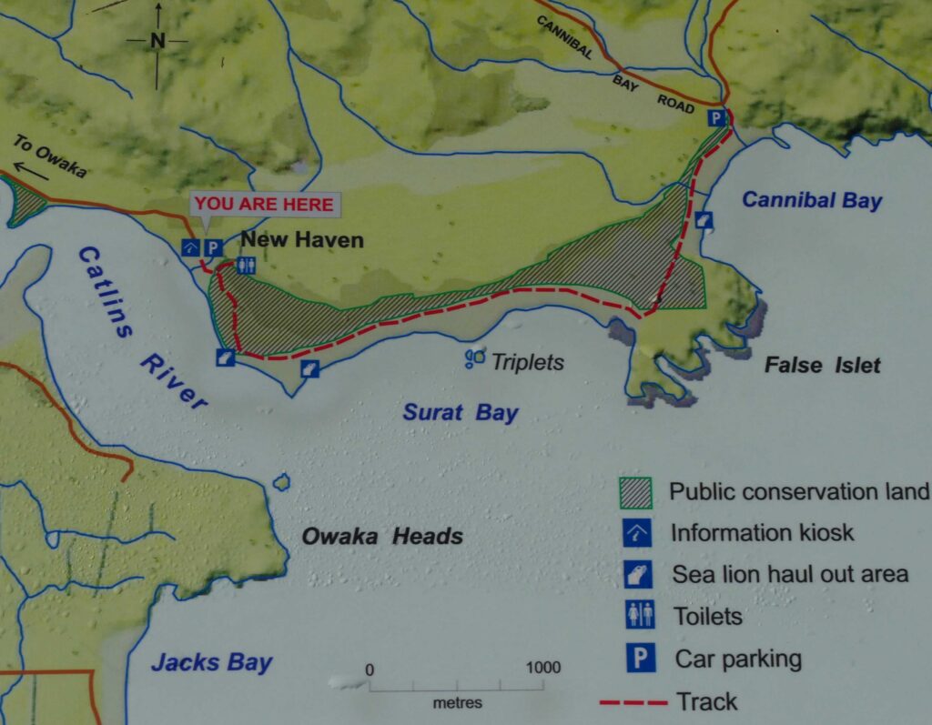
I thought it pertinent at this point to provide a map of this area. As we were travelling back to Christchurch to meet our daughter on a fixed date we had to pace ourselves throughout this part of the trip. We therefore skipped certain destinations that would take too much time to reach. In terms of the above map we skipped Jack’s Bay, largely Surat Bay (except as explained above) and False Islet, driving from New Haven across to Cannibal Bay.
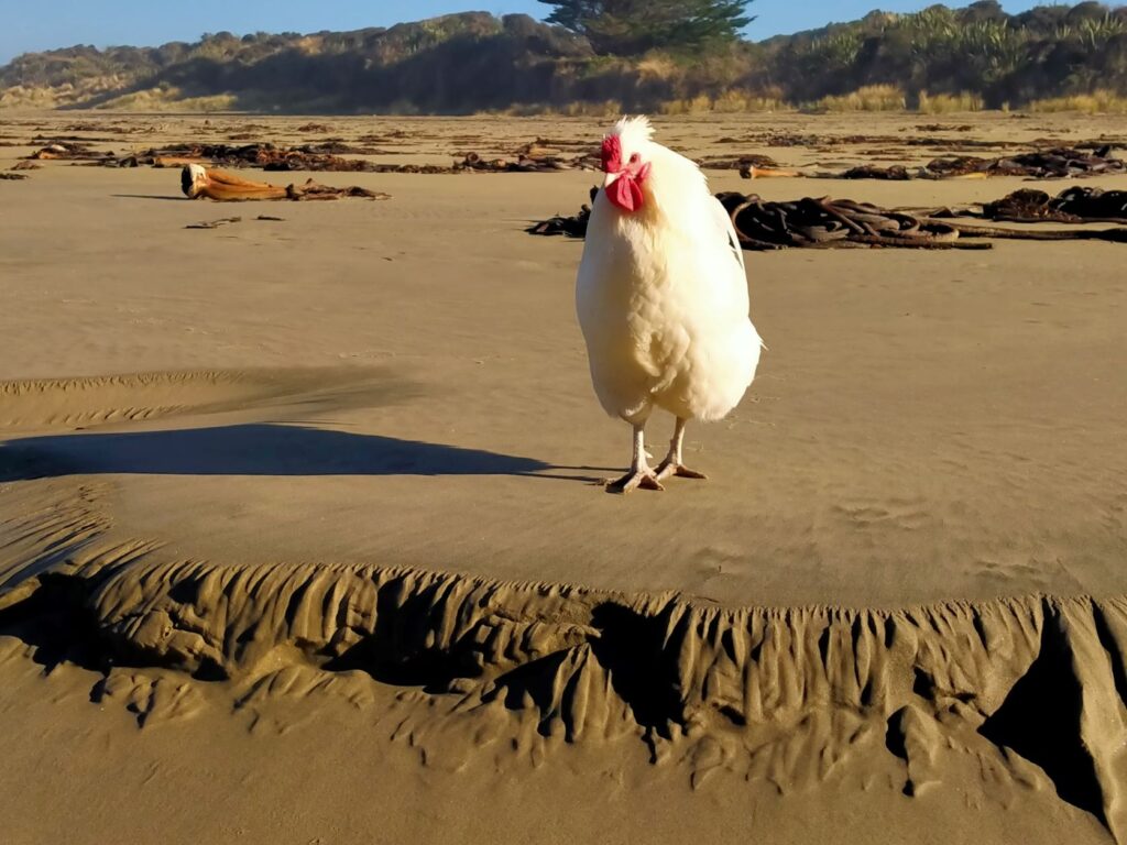
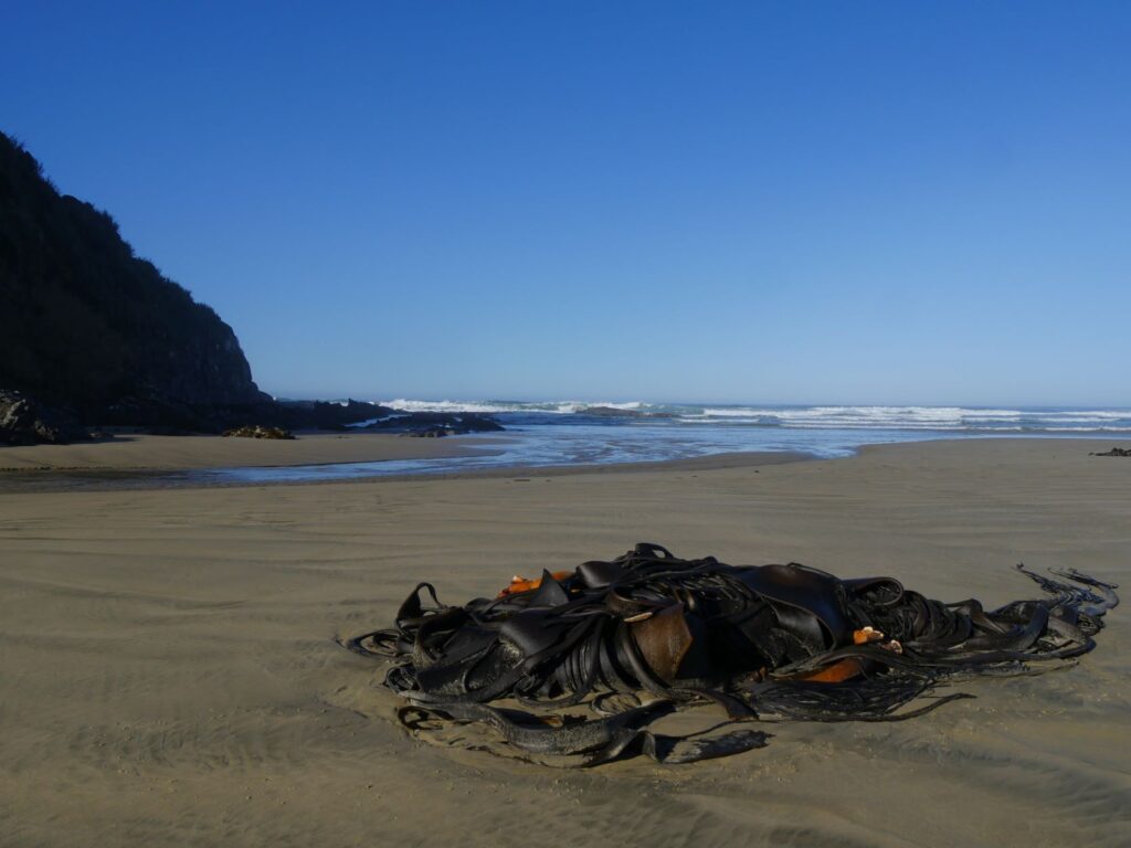
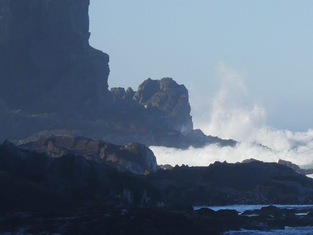
Cannibal Bay was named after human remains found by a surveyor some time in the past and is a bay also favoured by sea lions. We saw none (again!). On arrival we were immediately joined by three well groomed chickens who followed us on our exploration of the foreshore.. The sandy beach was similar to Purakaunui Bay, the compacted sand, which must be well graded, standing near vertical at the edges where abutting the river. Even though the day was calm the surf was boisterous, but breaking early, impaling itself on the rocky headland outcrops and sending spray skyward. On the near shoreline, which was very flat, the waves became gentle ripples coating the firm sand. The beach was strewn with kelp indicating we were visiting at low tide. The chickens seemed completely at home here, pecking away in the sand and following us around like well trained canines. By the tracks in the sand vehicles came down here, which is not surprising given how well compacted this sand is, so well in fact that the chickens did not even leave footprints!
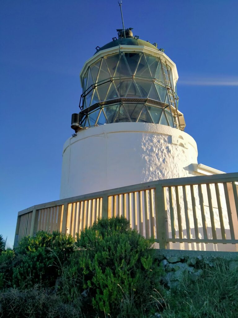
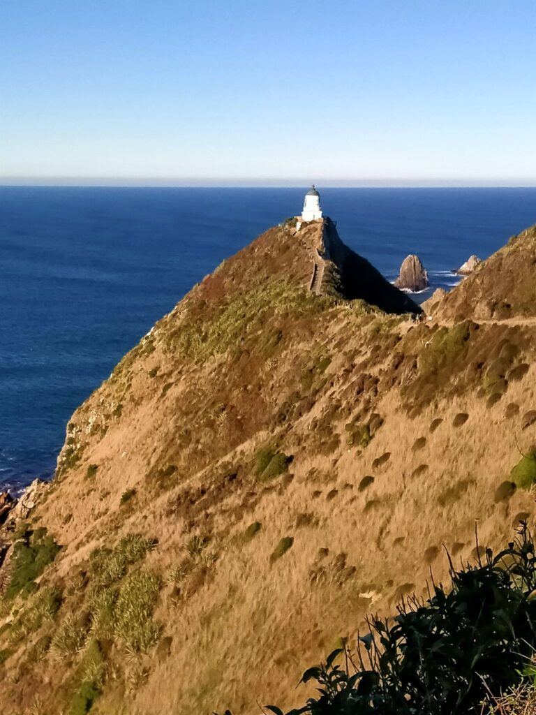
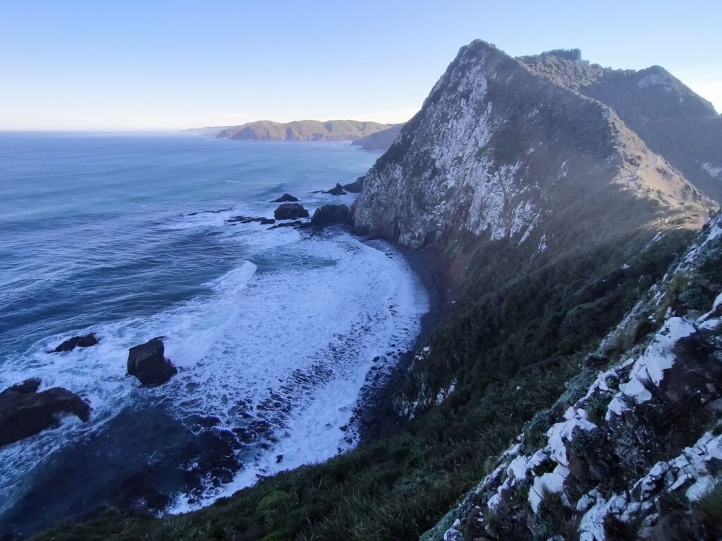
It was on to our last destination in the Catlins, Nugget Point, so named by Captain Cook because the rocks beyond the point looked to him like gold nuggets. The walk from the carpark to the panoramic viewing platform is 900 metres and takes about 15 minutes without stops. It’s a steady up hill climb on a mainly gravel path to the elevated lighthouse, one of NZ’s oldest. The viewing platform is cantilevered off the rock on the seaward side of the lighthouse, with steep rock faces falling around 70m to sea level below. As the literature states the sky meets the sea across the panorama in the distance. Huge rock faces rise to well above the viewing platform from the beach below, on the western side of the lighthouse . This is a very dramatic landscape and it is rare that a viewing platform is placed so precariously to allow the public access to a largely ‘birds eye view’. We were fortunate again that the weather allowed an enjoyable visit to this very exposed location. Only days after we left the point was lashed with 100 km/hr winds and rain, which is a fairly regular occurrence. It would be a brave soul that stood on the viewing platform int those conditions.
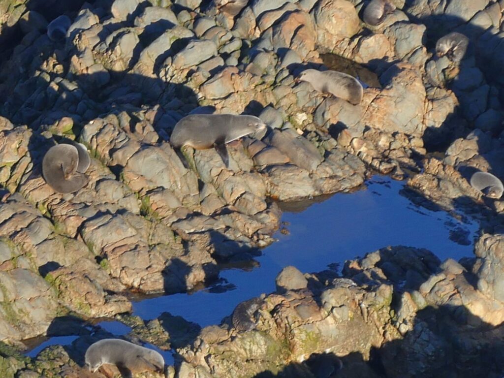
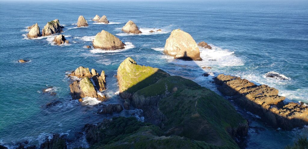
Wildlife abounds here and we could see a number of fur seals sleeping on the rocks below and others enjoying themselves in a rockpool. The ‘nuggets’ were coated in sunlight, perhaps as James Cook saw them, impressive against a deep blue ocean. The swell created a pattern of waves disappearing into the distance, while seabirds glided above them searching for a meal. There was a steady flow of visitors here, more than we had seen for some time, which indicated the popularity of this dramatic spot.
We stayed for some time taking numerous photos and videos, before saying adios to the Catlins and its myriad of forests, beaches and water features. We were fortunate to experience conditions that allowed us to see many sides of this highly acclaimed region and I trust the photos and recollections above will be our recommendation to put this on your must-do list. Hopefully we will be back to pick up those points of interest we missed and revisit others to experience them in a different season.
The Catlins – 08/06/21 To 12/06/21
/ South Island, Southland / By George
The Catlins were a much talked about destination by travellers we had met along the journey, and even our neighbours back home spoke exceptionally highly of this slice of the country, so we had high expectations of this area. On the way from Invercargill to our first destination in the Catlins, we stopped briefly at ‘Ashers Road’ to take a photo for our grandson Asher. Whilst at this road we quickly checked out ‘The Lignite Pit Cafe and Gardens’, which is a campground that accommodates motorhomes. We didn’t get a good look at the motorhome parking area unfortunately as we were intercepted by the proprietor. He was very pleasant and seemed keen for us to stay, but that wasn’t on our agenda. We had a quick look from the carpark whilst still in the wagon and the gardens and pond close to the camp area looked quite manicured. However our destination for tonight was Fortrose and the day was already well advanced. After travelling further we stopped briefly to view the whitebait huts lined up along the Mataura River. Whilst not in season you could imagine the throngs of resolute whitebaiters who return annually to this venue in search of contents for the mercurial ‘whitebait fritters’ (not too heavy on the egg!). Some come from as far away as the North Island to make ancestral pilgrimages to these huts.

FORTROSE
We certainly weren’t disappointed on the first night of our foray in the Catlins, arriving just in time to enjoy the most stunning sunset over a tranquil estuary, populated by a flock of swans. I’ll the let the photos begin the stories of the Catlins!


We were up early the next morning and caught the sun not long after it arose, whilst the tide was still low. The shoreline was predominantly formed of rounded stones of varied geology, whereas further out was sandy mud, deposited by the river toward the mouth of the estuary. The low tide enabled us to walk along the estuary edge and Debs in her gumboots could reach the few remains of the wreck of the INO, a steamship which ran aground on the ocean side of the Fortrose spit in 1886. There was no loss of life in this incident and in fact the motor was removed along with the boiler before the unmanned ship, being lighter, floated into the harbour and eventually settled in the mud, where she still lies today. Just a note of caution that it is muddy rather than sandy out by the wreck and Debbie said it was concerning how much she sank into this mud. At full tide this area is fully submerged including the remains
We left our camp location and drove up to the headland overlooking the spit, river mouth, bar and back down the estuary. I would add that our free-camp location on the edge of the estuary was ideal in the weather conditions we experienced, but no doubt is very exposed in adverse weather. We had to park up at the end of the hardstand road on the headland, although it was clear from the deep tracks that others drove on, much nearer to the cliffs. This was four-wheel-drive country beyond the hardstand though. With the slumping of the ground around the cliff edges we kept back, as the edge is not protected and is clearly unstable, steep and a significant height above the shoreline below. Also up the headland to the left of the road on the way up is the nine-hole Tokanui Golf Course. I’m no golfer but the course looked pretty challenging on a good day, with some serious uphill lies.

WAIPAPA POINT
Our next stop after Fortrose was Waipapa Point. Here there is a rocky shoreline and a home to fur seals and sealions commonly, although there were none in attendance that we saw during our visit. The lighthouse here was built in 1883and is still fully operational today, although the need for a lighthouse keeper became unnecessary in 1976, when the light was automated. This lighthouse was the first to be connected to the national electricity grid back in 1943, reducing the need for two keepers to one at that point. During our visit the weather was clear and the sea very moderate. The signs were there though of the commonly described ‘bleak, unforgiving stretch of coastline that challenges all living things’. There was a copious amount of beached and seabourne kelp, which seemed to be keeping a lonely black oyster catcher occupied.


A short driving distance from the Waipapa Point lighthouse and a walk across a farmer’s paddock is the remains of a graveyard that contains the bodies of the passengers of the SS Tararua. This ship, on its way to Bluff struck the reef at Waipapa Point on April 29 1881, in calm seas. At the time passengers held little fear for their safety and one of them swam the 300 yards to shore through the strong undertow to raise the alarm. Unfortunately the rescue ships were to arrive too late and despite several attempts to get passengers ashore there was no success. The seas became heavier and the last cries for help were heard at 2.30am on Saturday 30 April 1881 as the ship sank. Of the 151 passengers on board 131 lost their lives. This is still NZ’s worst civil sea disaster. The plaque indicates that 104 bodies were buried at the ‘Tararua Acre’ site, an area surveyed off for the purpose. There is very little to show for so many bodies lying in this acre today. There is a stone monument and plaque, a headstone erected by the children of Fortrose School, one headstone to victim William Bell and some low cast concrete domes that are perhaps markers of the grave sites. There is one further headstone, but this is for someone who died later in the 1880’s. Whilst we were photographing here it became apparent that this area and the field we had to cross, were completely covered by a blanket of fine spider webs. Never seen anything like it as it shimmered in the sun. We only saw one small spider on inspection, but surely he wasn’t working alone!

SLOPE POINT & WAIKAWA BAY
Eastward we moved and deeper into the Catlins toward our night stay location of Waikawa Bay. The Catlins has so many places and features to see on the way between ‘towns’, it was always uncertain whether we would make our intended stayover destinations. We did in this case, although we did detour down to Slope Point, the southern most spot in the South Island. We stopped at the carpark to the Slope Point walk and after some reconnaissance and deliberation did not take the walk. A large muddy field occupied by some friendly but inquisitive looking bulls confronted us, with a sign on the gate that stated we were to ‘enter at our own risk’ as the area contained animals. After a previous altercation with a bull on the Hauraki Rail Trail in the North Island, we weren’t prepared to venture further considering you can’t outrun a bull and the paddock escape route over the electric fence didn’t excite us either! Debbie took photos of the bulls and a long shot of Foveaux Strait in the distance and we left, half ticking the box that we had reached this southernmost milestone.

After leaving Slope Point we headed straight for Waikawa as the sun was sinking fast. We stopped briefly where I think an attempt was being made on the Guinness Book of Records “most sheep in a paddock’. We also stopped at Haldane Bay and shot a few photos of the glassy waters from the gravelly section of main road opposite the bay, where it appears a ford may form on occasions.

On arrival Waikawa Bay was presenting spectacularly in the sunset. The aging and rustic wharf, together with the adjacent weathered and ill-maintained elevated boat-shed(?), were a stark shadowy contrast to the reflection of hills and clear blue sky on the gently flowing waters of the bay. This was truly a NZ waterfront mercurial scene with those remnants of historical makeshift structure defying time and getting their moments of artistic glory, never imagined at the time of construction for pure practicality. As the water drifted lazily toward the ocean the kelp caught around the wharf piles danced in the water like a flowing veil. Historically like many Southland towns the port here was once very busy up until the 1920’s when shipping ceased. Prior to this it was a major port for shipping timber, but because of ‘silting-up’ Fortrose became more prominent and Waikawa Bay declined even further with the arrival of branch railway.


CURIO BAY
The weather deteriorated on 10 May and we awoke to uninviting rain and wind at Waikawa Recreation Reserve free-camp, which was thankfully a hardstand area behind the local hall, with toilets. Still, we had a schedule to keep and headed for Curio Bay, donning all our wet-weather gear to visit this southern coast bay being lashed by squalls. Instead of parking near the visitor centre/café we stopped in the public carpark nearer the headland.

It was a bit of a walk to finally locate our target; the petrified forest. We foolishly hadn’t even bothered to check the tides and we were very fortunate that it was low and the fossils on show here were fully exposed. The rain had abated by the time we descended the well constructed staircase to the rocks, but the wind was still sending waves crashing onto the furthermost outcrops. However, you didn’t need to venture far out from the bottom of the stairs to see the impressive fossilised fallen trees and trunks, solid stone for 170 million years. The trees, according to scientists, turned into stone in a matter of months when impregnated by silica rich floodwaters from volcano runoff laden with ash. Years of pounding by the seas have worn away the upper layers of soil to expose the fossils.
These rocks are also home to the rarest penguin in the world, the Hoiho, or Yellow-Eyed Penguin. Apparently there are three that live here permanently, but they leave the land at dawn and return just before dusk. As usual we arrived too late for the dawn viewing and couldn’t wait for their return.
After our time at the ‘Jurassic’ forest we were in need of a hot drink and sustenance, so retreated to the café. Herein also lies the CurioScape interactive museum, which we could view for a small donation since we had purchased brunch at the café. This was an extremely worthwhile experience which took us around an hour to view. Items of note here were:
- An interactive map of the Catlins highlighting all the major points of interest;
- Touchable examples of petrified tree stumps, ferns and tree trunks in their stone matrix;
- An interactive history of the formation of the petrified forest;
- A history of the formation of New Zealand geologically from 220 million years ago, showing the breakup of the continents;
- A cinematic presentation of the formation of New Zealand including excerpts from Maori legend through to European colonization; the impact of the various occupiers of this land and initiatives underway to restore environmental balance.


After feeling diminished as an individual in the scale of NZ’s creation, we ventured out onto the rugged headland. The waves were impaling themselves on the rocky outcrops, leaving waterfalls cascading down the tiered faces as the wave receded. Cormorants sat atop granite pillars preening themselves as the waves battered the cliffs beneath them. Swathes of kelp swam in the constant ebb and flow of the waters, with much being lifted and eventually stranded on the rocky shore. Here is a place where history is laid bare and the constant movement never ceases in reshaping the landscape. We spent around 3.5 hours here in total before moving on to the Koropuku Falls.

KOROPUKU FALLS
The walk to the falls, which takes around 20 minutes excluding photo stops is relatively straight forward, the path being overladen with transverse punga logs for stable footing in many places. The track proceeds through a luxuriant native forest, with careful footing required over the last few metres as you traverse damp rocks and a crude single timber plank bridge supported by two waratahs as hand-holds. It had been raining prior to our visit and the route to see the pond directly below the falls looked treacherous, so we took our photos just prior to the pond. These ‘curtain’ falls cascade about 10m and thanks to the rain had a good flow while we were there. Definitely a worthwhile walk through the native forest resplendent in various ferns and mosses.

PAPATOWAI DOC CAMP
Our stayover on the night of 10/05 was at Papatowai DOC camp, which was deserted except for one other campervan. It was wet so we chose a hardstand site – there was a lot choice but most sites were on the grass. We had stopped at ‘The Lost Gypsy Gallery’ just prior to arriving at the camp, but unfortunately it was closed. Debbie shot some photos anyway to highlight the eccentric creations that exist here.


The camp provided direct access to the estuary leading out to Tahakopa Bay. We were fortunate again that the evening was still, particularly after the start to the day and the sky a dusky blue, providing an extremely peaceful scene and resulting mirrored images on the estuary. We were learning that the weather down here was extremely changeable.


The motels, store and service station at the entrance to the camp were all closed. The camp itself had flush toilets, a rubbish skip and an amenity block including a kitchen with sinks, but no other equipment, appliances or utensils. There was no potable water here. We boiled the tap water from the kitchen as directed but it sill looked unpalatable to us. There were some outside tables and chairs, but it was far too cold for us to use them and they were damp anyway. I can imagine that it is a camp that would be heavily populated by beach-bums and holiday-makers in summer and infested by sandflies, as many locations near water are down here.
We stayed the one night here waking to a very frosty morning with nearby puddles frozen over. We took another walk down to the estuary, which was almost entirely bereft of water, as the tide was well out. Came across a couple of locals who had had obviously lived here for some time (see photos below). We had much to see today again, so exited early leaving the camp deserted, since the ‘slidie’ had departed before us.

PAPATOWAI TO PURAKAUNUI BAY
Our first stop of the day (11/05) was Florence Hill lookout, just southwest of Papatowai. This overlooks Tautaku beach and peninsula, where the waves were rolling lazily in under a clear sky. There was little wind, but it was nonetheless cool after last night’s frost. An information board advised the average temperature here is 11degC ranging from -9degC to 30degC. Rainfall around 1200mm per annum is the same as Auckland. The only mention of wind was that it was ‘ever-changing’! The beach is completely forest fringed and appeared blemish free of rocks, driftwood and kelp. Direct beach access is available to four-wheel-drive vehicles and these factors, plus the huge swells that can drive up from the southern ocean, make this a popular surfing destination. It is nonetheless remote and fur seals, sealions and yellow-eyed penguins frequent this bay, along with the occasional whale. We saw none from our high vantage point however and didn’t have time to venture down into the bay.

Next stop was Lake Wilkie, about a 30 minute return walk from the road. The lake was formed by water trapped in a depression between ancient sand dunes and a cliff. However it is diminishing in size and is called a ‘bog lake’, brown in colour due to organic acids released by the peaty soils. It was an easy walk to the lake with excellent viewing from the boardwalk at the lake edge. Information boards along the track explain the zones of fauna visible here. The podocarp forest with the native Rimu and Southern Rata was lush with crown ferns, whilst the lake was still and reflecting clearly everything above the surface. One day sadly the lake will cease to exist, but in the meantime we would recommend the walk!

Onward we went to the Tautuku Estuary boardwalk, another which is about 30 min return from the carpark, always dependent on the number of photos you take and information signs you read. Another easy walk with an old sawmill location en-route to the boardwalk. We couldn’t see any sign of mill remnants through the ferns and bush in the area of the sign. Maybe there actually weren’t any remains? The boardwalk takes you through a massive field of ‘jointed rush’ and out to the viewing platform. The area is home to the ‘fern bird’, described as a shy sparrow-sized bird that is a reluctant flyer. It was certainly both those things as we didn’t see any sign of it here. Instead Debs resorted to spider web droplet photos for creative impetus. The exposed gnarly roots of the trees on the bank beside the forest section of the walk were a rarely seen subterranean cross-section.

At the beginning of the walk there was a boggy path leading to what the sign suggests is the ‘1906 Pioneer Home’. We braved the wet and muddy track ploughed into furrows by vehicles, but only located a piece of an old concrete slab and part of an abandoned aging corrugated iron tank. Not sure if this was what we were supposed to identify as the home, as there was no further signage. I delved deeper into the forest, which was notable for the mature native trees but still found no sign of a home. The varying features of the Catlins continue to roll out like some geography field trip.


Sadly at our next stop we learnt the drawbacks of travelling in the winter. The much lauded Cathedral Caves was closed for the winter months. We had heard that, but went to the entry gate as we were passing any way, to verify it for ourselves. Disappointing, but just another reason to return in the future.
There was still much to see though and our next stop was the McLean Falls, a 40 minute return walk through more DOC native bush. There was a tinge of precarious adventure near the last part of the walk where the “don’t stop falling rocks’ signs prompt you past an overhanging rockface of dubious stability. Clearly slips have occurred here in the past and you ask yourself if it’s been raining a lot recently. The falls themselves are 22m high and a must see. The water of the Tautuku River cascades over layers of rocks and away down the ‘Chute’, which is a water-race come waterfall itself just below the main falls, but not as visible. It was time for Debbie to pull out all her photography experience, to enhance an already stunning sight and capture that inimitable effect of ethereal movement. I did some Slo-mo video recording of the scene to capture some footage for later production! Check out “Going with the Flow” in our music section.


The day was still far from over and it was the Matai Falls next. This is a 30 minute return walk, with a further 5 minutes onto the Horseshoe Falls. In reality most of these walks and waterfall viewings took us at least 30 minutes longer than the prescribed time on the carpark signs. Both the Matai and Horseshoe Falls were not as impressive as the McLean Falls, albeit slightly different in formation. Nonetheless they were still worthy of a visit and continued the full immersion in NZ’s native wonderland. It astonishing how much natural splendour is able to be viewed in just few hours. On the walk back from the falls we took the detour to view the Catlins Branch Railway Walking Trail. We didn’t have time to walk the trail, which required another hour to complete as the day was drawing on, but it highlighted again that despite what we saw there was still much left unseen. The photos below depict the Matai Falls on the left and Horseshoe Falls on the right.


The final drive of the day took us to a remote Purakaunui Bay and it was nearing darkness when we finally arrived. Despite the isolation there were a number of ‘slidies’ in attendance, occupied mainly by what appeared to be surfers. We managed to get a few photos before the darkness completely enveloped the bay, although one young couple suitably rugged up had a campfire burning and were sipping on mugs no doubt containing warm fluid of some description. The fire provided a glow characteristic of the camps of our young days. Full body wetsuits hung outside one van, but I was sure there would be no further drying for those during this night. The last of the ‘day surfers’ left the camp and most of the night campers retreated to the warmth of their vehicles as the temperature plummeted. This would be a welcome reward no doubt for bracing what looked to me like a savage surf break in very cold and uninviting waters. Despite the holistic beauty of the bay, surfing here at this time of year was seriously hardcore in my opinion and I would never have contemplated that at any time in my life! I will applaud those that do.

Debbie was up at dawn the next morning (12/05) in search of something photographically magical in the sunrise. I followed soon after. The scene was one of beauty and the beast. The surf was ominous with spray whipping off the crest of the breakers, the waves then calming and ambling toward the shore where it licked the rock outcrops and coated the smooth sand like resin, to reflect the light of the dawn.


At the outlet of the Purakaunui River a circular sand bar had been created with small vertical sides on the perimeter. It appeared almost as a stage surrounded by a moat. The cast of one eventually arrived in the form of a sealion slowly making its way up the beach but, as they do, shying away from the limelight and remaining ‘backstage’


The road to the camp continues a short distance beyond the camp, taking a steep rise to a vantage point overlooking the bay. This affords some good views over the bay. The banks contain trees that tell a story of the ferocious winds that batter the bay and rise up the surrounding hills.
PURAKAUNUI BAY TO NUGGET POINT
After ‘milking’ the beauty of the sunrise and downing another cereal breakfast it was time to move into what would be our last day in the Catlins. It had dawned with a very heavy frost, causing the water in the potholes around our wagon to become completely frozen. As we drove out of the bay and through the adjoining farmland the shaded areas along the roadside and in farm paddocks were icy white and the roads similarly. We took the drive slowly because of the treacherous icy conditions as we headed for yet another waterfall. It was becoming like the cathedrals of Europe, “Oh no not another one”.

From the carpark it is a 10 minute easy walk to the Purakaunui Falls on mostly gravelled surfacing through native forest. The falls themselves are around 20m in height and cascade over three tiers, but are wider than the McLean Falls. It is described in some literature as ‘NZ’s most photographed falls’ and there were a number of visitors when we were there on 12/06/21. We spent about an hour here as Debbie experimented with various shutter speeds to get some notable photos. There was a photographer on the track working to get a truly memorable shot of the river and forest so we thought. On closer inspection he was using artificial lighting and and a cherry tree branch ‘prop’ unrelated to the fauna here. Of course creativity is not necessarily reality and I shouldn’t really wonder why the ‘point and shoot’ attempts off my cellphone never quite meet the professional level! The falls were iconic given their width and quintessential cascade over natural rock benching. Fortunately once again we had had enough recent rainfall to provide a steady flow over the falls and down the Purakaunui River (see photo right).
No time to beat about as it was off to Catlins Lake. It was just a quick stop here for a couple of photos. Geographically Catlins Lake is actually the upper estuary of the Catlins River, so is tidal. Part of the lake was offering reflections of the landscape while the saturated mudflats mirrored the sky in a completely contrasting ‘nuclear fusion’ effect. Despite the fact that clearly the tide was not full there was considerable scenic artistic merit on this stunningly clear sunny morning (see photo below).

We next called into the township of Owaka and stumbled upon another of those ‘Op Shops’, where it was a struggle to discern if it was a retail shop or museum (probably both) and therefore what was actually for sale. It’s always embarrassing to ask too! There was the usual array of novels and antiquated non-fiction, LP records, vehicle registration plates, hubcaps, a BSA and Royal Enfield motorcycle and a window display featuring an old pushbike, the bottom half of a mannequin, a selection of exotic carved heads in various mediums (some hideous) and the proprietor’s two cats, one of which was suffering from arthritis. A shop of oddities. The proprietor actually motioned us across to her display of homemade soaps of various local fragrances. This was her actual claim to fame. Still she gave us some semi-useful directions and we went on our way typically empty handed. We did take a couple of photos at ‘Teapotland’, which resides in a house down the road, but skipped the full tour so we could justifiably avoid the donation box. We also missed the museum although the Op shop we saw was a pretty good attempt at that!

Our next port of call was Surat Bay, which was another fleeting visit and we only went as far as New Haven (see map below), which is the start of the walk around the bay. Located on the eastern side of the Catlins River mouth it is a very popular beach for sea lions. It has a very informative sign explaining clearly the difference between seals and sea lions, which was useful for us North Island townies. We didn’t venture down onto the beach and couldn’t see any sea lions so moved on to Cannibal Bay.

I thought it pertinent at this point to provide a map of this area. As we were travelling back to Christchurch to meet our daughter on a fixed date we had to pace ourselves throughout this part of the trip. We therefore skipped certain destinations that would take too much time to reach. In terms of the above map we skipped Jack’s Bay, largely Surat Bay (except as explained above) and False Islet, driving from New Haven across to Cannibal Bay.
Cannibal Bay was named after human remains found by a surveyor some time in the past and is a bay also favoured by sea lions. We saw none (again!). On arrival we were immediately joined by three well groomed chickens who followed us on our exploration of the foreshore.. The sandy beach was similar to Purakaunui Bay, the compacted sand, which must be well graded, standing near vertical at the edges where abutting the river. Even though the day was calm the surf was boisterous, but breaking early, impaling itself on the rocky headland outcrops and sending spray skyward. On the near shoreline, which was very flat, the waves became gentle ripples coating the firm sand. The beach was strewn with kelp indicating we were visiting at low tide. The chickens seemed completely at home here, pecking away in the sand and following us around like well trained canines. By the tracks in the sand vehicles came down here, which is not surprising given how well compacted this sand is, so well in fact that the chickens did not even leave footprints!


It was on to our last destination in the Catlins, Nugget Point, so named by Captain Cook because the rocks beyond the point looked to him like gold nuggets. The walk from the carpark to the panoramic viewing platform is 900 metres and takes about 15 minutes without stops. It’s a steady up hill climb on a mainly gravel path to the elevated lighthouse, one of NZ’s oldest. The viewing platform is cantilevered off the rock on the seaward side of the lighthouse, with steep rock faces falling around 70m to sea level below. As the literature states the sky meets the sea across the panorama in the distance. Huge rock faces rise to well above the viewing platform from the beach below, on the western side of the lighthouse . This is a very dramatic landscape and it is rare that a viewing platform is placed so precariously to allow the public access to a largely ‘birds eye view’. We were fortunate again that the weather allowed an enjoyable visit to this very exposed location. Only days after we left the point was lashed with 100 km/hr winds and rain, which is a fairly regular occurrence. It would be a brave soul that stood on the viewing platform int those conditions.


Wildlife abounds here and we could see a number of fur seals sleeping on the rocks below and others enjoying themselves in a rockpool. The ‘nuggets’ were coated in sunlight, perhaps as James Cook saw them, impressive against a deep blue ocean. The swell created a pattern of waves disappearing into the distance, while seabirds glided above them searching for a meal. There was a steady flow of visitors here, more than we had seen for some time, which indicated the popularity of this dramatic spot.
We stayed for some time taking numerous photos and videos, before saying adios to the Catlins and its myriad of forests, beaches and water features. We were fortunate to experience conditions that allowed us to see many sides of this highly acclaimed region and I trust the photos and recollections above will be our recommendation to put this on your must-do list. Hopefully we will be back to pick up those points of interest we missed and revisit others to experience them in a different season.